Brinklow Castle
Contenu soumis à la licence CC-BY-SA. Source : Article Brinklow Castle de Wikipédia en français (auteurs)
Regardez d'autres dictionnaires:
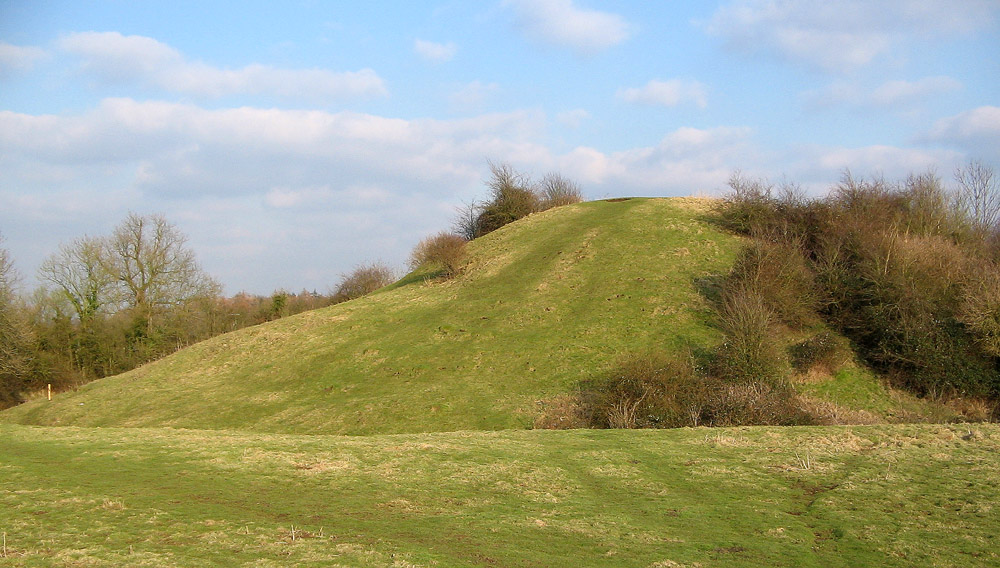
Brinklow Castle — known locally as The Tump was in the village of Brinklow in the county of Warwickshire between Coventry and Rugby (gbmapping|SP438796).This was a Norman earthwork motte and bailey castle which was founded by Robert de Mowbray to guard the Fosse… … Wikipedia
Brinklow (disambiguation) — Brinklow may refer to:Places: * Brinklow, a village in Warwickshire, England ** Brinklow Castle a former castle in the north of the village of Brinklow, Warwickshire, England * In Milton Keynes, Brinklow is one of the districts that make up the… … Wikipedia
Brinklow — Infobox UK place country = England official name= Brinklow latitude= 52.40909 longitude= 1.36342 civil parish = Brinklow population = 1,041 shire district= Rugby shire county= Warwickshire region= West Midlands constituency westminster= Nuneaton… … Wikipedia
Brinklow — 52°24′32.72″N 1°21′48.31″O / 52.4090889, 1.3634194 … Wikipédia en Français
Coventry Way — A section of the Coventry Way path in Kenilworth The Coventry Way is a 40 mile (64 km) long distance footpath in central England that starts and finishes in Meriden. It forms a circular route around the city of Coventry covering… … Wikipedia
Warwickshire — Warwickshire … Wikipedia
Fosse Way — Carte des voies romaines en Bretagne romaine Foss … Wikipédia en Français
Oxford Canal — The Oxford Canal as seen from Napton on the Hill in Warwickshire The Oxford Canal is a 78 mile long (126 km) narrow canal in central England linking Oxford with Coventry via Banbury and Rugby. It connects with the River Thames at Oxford, to… … Wikipedia
List of bus routes in the West Midlands county — A map which shows the area these routes operate in. This is a list of all the Network West Midlands bus routes in the West Midlands, England. Contents 1 … Wikipedia
Maps of castles in England by county — The castles displayed on each map are those listed in the List of castles in England for the corresponding county or area. Click on the red or green dot to display a detailed map showing the location of the castle. Green dots represent for the… … Wikipedia
 Motte castrale de Brinklow