Zákolany
Contenu soumis à la licence CC-BY-SA. Source : Article Zákolany de Wikipédia en français (auteurs)
Regardez d'autres dictionnaires:
Zákolany — Geobox | Settlement name = Zákolany other name = category = Village image caption = | flag border = 1 symbol = Zakolany znak.gif etymology = official name = motto = nickname = country = Czech Republic country state = region = Central Bohemian… … Wikipedia
Antonín Zápotocký — Infobox President name=Antonín Zápotocký imagesize = 105px order = 6th office= President of Czechoslovakia term start=21 March, 1953 term end= 13 November, 1957 predecessor=Klement Gottwald successor= Viliam Široký (acting) order2 = 16th office2 … Wikipedia
Kladno District — Okres Kladno District City Hall and Baroque Marian Column in Kladno … Wikipedia
Blevice — Geobox | Settlement name = Blevice other name = Blewitz other name1 = category = Village image caption = Blevice as seen from northwest symbol = etymology = official name = motto = nickname = country = Czech Republic country state = region =… … Wikipedia
Bahnstrecke Praha–Most — Praha Smíchov–Most Kursbuchstrecke (SŽDC): 110, 121, 123, 173 Spurweite: 1435 mm (Normalspur) Stromsystem: Obrnice–Most: 3 kV = Höchstgeschwindigkeit: 70 km/h Legende … Deutsch Wikipedia
Bahnstrecke Kladno–Kralupy nad Vltavou — Kladno–Kralupy nad Vltavou Kursbuchstrecke (SŽDC): 093 Streckenlänge: 25,076 km Spurweite: 1435 mm (Normalspur) Streckenklasse: C4 Höchstgeschwindigkeit: 60 km/h Legende … Deutsch Wikipedia
Družec — Coordinates: 50°06′09″N 14°02′42″E / 50.1025°N 14.045°E / 50.1025; 14.045 … Wikipedia
Doksy (Kladno District) — For the town of the same name in Liberec Region, see Doksy. Coordinates: 50°7′7″N 14°2′46″E / 50.11861°N 14.04611°E / … Wikipedia
Antonín Zápotocký — (* 19. Dezember 1884 in Zákolany bei Kladno, Böhmen; † 13. November 1957 in Prag) war ein tschechoslowakischer Gewerkschaftsführer und Politiker. Zápotocký war zunäc … Deutsch Wikipedia
Bielok — Běloky … Deutsch Wikipedia
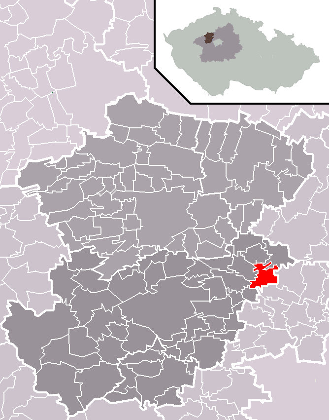
 La municipalité de Zákolany (rouge) dans le disctrict de Kladno (gris foncé)
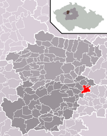