Woolage Green
- Woolage Green
-

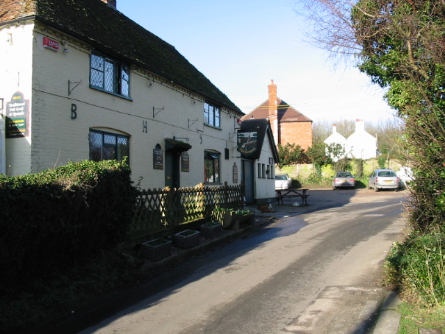
Un pub à Woolage Green,
dans le Kent.
Woolage Green est un petit hameau, Situé à environ 7 miles (11 km) au sud-est de Canterbury, dans le Kent, en Angleterre, 1 mile à l'est de l'A2. Il forme avec Womenswold et Woolage Village, le civil parish de Womenswold .
Woolage Green est composé de quelque 36 habitations, dont un pub the Two Sawyers.
Wikimedia Foundation.
2010.
Contenu soumis à la licence CC-BY-SA. Source : Article Woolage Green de Wikipédia en français (auteurs)
Regardez d'autres dictionnaires:
Woolage Green — infobox UK place country = England latitude= 51.20 longitude=1.202 static static image caption=The Two Sawyers pub, Woolage Green official name=Woolage Green population = shire district= City of Canterbury shire county = Kent region= South East… … Wikipedia
Woolage Village — infobox UK place country = England latitude= 51.205 longitude=1.20 static static image caption=View of Woolage Village official name=Woolage Village population = shire district= City of Canterbury shire county = Kent region= South East England… … Wikipedia
Canterbury — For the larger local government district, see City of Canterbury. For other uses, see Canterbury (disambiguation). Coordinates: 51°16′30″N 1°05′13″E / 51.275°N 1.0 … Wikipedia
Chartham — Coordinates: 51°15′18″N 1°01′14″E / 51.255°N 1.0205°E / 51.255; 1.0205 … Wikipedia
City of Canterbury — For the settlement within the City of Canterbury, see Canterbury. For the local government area in Australia, see City of Canterbury (New South Wales). City of Canterbury Non metropolitan district, Borough, City … Wikipedia
Chartham Hatch — Coordinates: 51°15′18″N 1°01′14″E / 51.255°N 1.0205°E / 51.255; 1.0205 … Wikipedia
Marshside, Kent — Coordinates: 51°21′03″N 1°11′35″E / 51.3508°N 1.1931°E / 51.3508; 1.1931 … Wikipedia
Chislet — Coordinates: 51°20′11″N 1°11′28″E / 51.336330°N 1.191000°E / 51.336330; 1.191000 … Wikipedia
Womenswold — infobox UK place country = England official name= Womenswold latitude= 51.213 longitude= 1.1886population = civil parish= shire district= City of Canterbury shire county= Kent region= South East Englandconstituency westminster= Canterbury post… … Wikipedia
Chestfield — Coordinates: 51°21′18″N 1°03′50″E / 51.355°N 1.064°E / 51.355; 1.064 … Wikipedia