Birchip
- Birchip
-
Birchip (683 habitants) est un village du Victoria situé à 312 km au nord-ouest de Melbourne sur la Sunraysia Highway.
On y cultive surtout des céréales et de la canola.
Références
Wikimedia Foundation.
2010.
Contenu soumis à la licence CC-BY-SA. Source : Article Birchip de Wikipédia en français (auteurs)
Regardez d'autres dictionnaires:
Birchip, Victoria — Infobox Australian Place | type = town name = Birchip state = vic caption = Location of Birchip in Victoria (red) lga = Shire of Buloke postcode = 3483 est = pop = 822 (2006)Census 2006 AUS | id = SSC25165 | name = Birchip (State Suburb) |… … Wikipedia
Birchip railway station, Victoria — VictorianClosedRailwayStation NAME=Birchip LINE=Mildura DISTANCE=348.46 km PLATFORMS= 1 TRACKS= 1 STATUS=Closed OPENED=1893 CLOSED=1993 http://maps.google.com/maps?f=q hl=en q=Birchip+Station,+Victoria,+Australia sll= 36.36836,142.987932… … Wikipedia
Shire of Birchip — Infobox Australian Place | type = lga name = Shire of Birchip state = vic region = area = 1468 est = 1895 seat = Birchip pop = 1270 (1992) [cite book|title=Victorian Year Book|author=Australian Bureau of Statistics, Victoria Office|year=1994|page … Wikipedia
North Central Football League — The North Central Football League is an Australian rules football league based in North Central Victoria, Australia. The League was formed in 1930. Previous leagues in the area were the North Western Football Association (1913–1919), the North… … Wikipedia
Calder Highway — bei Irymple … Deutsch Wikipedia
Shire of Donald — Infobox Australian Place | type = lga name = Shire of Donald state = vic region = area = 1448 est = 1861 seat = Donald pop = 2540 (1992) [cite book|title=Victorian Year Book|author=Australian Bureau of Statistics, Victoria… … Wikipedia
Shire of Wycheproof — Infobox Australian Place | type = lga name = Shire of Wycheproof state = vic region = area = 4110.3 est = 1894 seat = Wycheproof pop = 3130 (1992) [cite book|title=Victorian Year Book|author=Australian Bureau of Statistics, Victoria… … Wikipedia
Shire of Buloke — Infobox Australian Place | type = lga name = Shire of Buloke state = vic caption = Location in Victoria pop = 6,853 (2006 Census) area = 8004 est = seat = Wycheproof mayor = Reid Mather region = url = http://www.buloke.vic.gov.au/ stategov =… … Wikipedia
Sunraysia Highway — Infobox Australian Road road name = Sunraysia Highway route route route photo = caption = Formerly length = 344 direction = Northwest Southeast start = , Nunga, Victoria finish = est = through = Birchip, Donald, St. Arnaud, Avoca route = exits =… … Wikipedia
Donald, Victoria — Donald Victoria Main street passing through Donald … Wikipedia
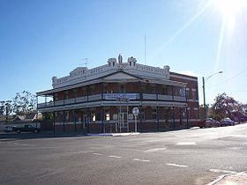 L'hôtel de Birchip
 Australie

