Vozuća

Vozuća

44° 22′ 42″ N 18° 22′ 01″ E / 44.3783, 18.3669

Vozuća
Возућа
Administration
Pays Drapeau de Bosnie-Herzégovine Bosnie-Herzégovine
Entité Drapeau de la Fédération de Bosnie-et-Herzégovine Fédération de Bosnie-et-Herzégovine
Canton Zenica-Doboj
Municipalité Zavidovići
Géographie
Coordonnées 44° 22′ 42″ Nord
       18° 22′ 01″ Est
/ 44.3783, 18.3669
Démographie
Population 1 948 hab. (1991)
Localisation
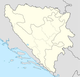
Bosnia and Herzegovina location map.svg
City locator 15.svg
Vozuća

Vozuća (en serbe cyrillique : Возућа) est un village de Bosnie-Herzégovine. Il est situé dans la municipalité de Zavidovići et dans le canton de Zenica-Doboj, Fédération de Bosnie-et-Herzégovine. Au recensement de 1991, il comptait 1 948 habitants, dont une majorité de Serbes[1].

Sommaire

Démographie

Répartition de la population (1991)

Nationalité Nombre %
Serbes 1 305 66,99
Musulmans 596 30,59
Yougoslaves 16 0,82
Croates 6 0,30
Inconnus/autres 25 1,28[1]

En 1991, la communauté locale de Vozuća comptait 4 446 habitants, répartis de la manière suivante[2] :

Nationalité Nombre %
Serbes 2 296 51,64
Musulmans 2 051 46,13
Yougoslaves 50 1,12
Croates 13 0,29
Inconnus/autres 36 0,81

Notes et références

  1. a et b (bs)(hr)(sr) Livre : Composition nationale de la population - Résultats de la République par municipalités et localités 1991, Bulletin statistique n°234, Publication de l'Institut national de statistique de Bosnie-Herzégovine, Sarajevo.
  2. (bs)(hr)(sr)[PDF] Recensement par communautés locales sur http://www.fzs.ba, Bosnie-Herzégovine - Fédération de Bosnie-et-Herzégovine - Institut fédéral de statistique. Consulté le 11 octobre 2010

Voir aussi

Articles connexes

Lien externe


Wikimedia Foundation. 2010.

Contenu soumis à la licence CC-BY-SA. Source : Article Vozuća de Wikipédia en français (auteurs)

Игры ⚽ Поможем решить контрольную работу

Regardez d'autres dictionnaires:

  • Vozuca — Original name in latin Vozua Name in other language State code BA Continent/City Europe/Sarajevo longitude 44.35878 latitude 18.35397 altitude 326 Population 3209 Date 2012 04 06 …   Cities with a population over 1000 database

  • 2nd Corps of the Army of the Republic of Bosnia and Herzegovina — Infobox Military Unit unit name= 2nd Corps caption=2nd Corps Patch dates= April 1992 country= flagcountry|Bosnia and Herzegovina|1992 allegiance= garrison= Tuzla branch= Regular Army type= Motorized, Mountain and Infantry role= Defence of Tuzla… …   Wikipedia

  • Zavidovići — 44° 26′ 45″ N 18° 08′ 59″ E / 44.4458, 18.1497 …   Wikipédia en Français

  • Hilandar — Хиландар Monastery information Full Name Хиландар Order Serbian Orthodox …   Wikipedia

  • Stefan Nemanja — Стѣфань Неманя Стефан Немања Grand Prince of Rascia The fresco of Saint Simeon (Stefan Nemanja), King s Church in Studenica monastery Gran …   Wikipedia

  • Serbian Orthodox Church — Српска православна црква Srpska pravoslavna crkva Cathe …   Wikipedia

  • Devič — For other uses, see Devic (disambiguation). Devič Monastery Devič Monastery reconstruction after it was burned down in 2004 Monastery information Full Name Манастир Девич …   Wikipedia

  • Our Lady of Ljeviš — Medieval Monuments in Kosovo * UNESCO World Heritage Site Country …   Wikipedia

  • Ostrog monastery — Monastery of Ostrog. Monastery information Full Name Манастир Острог Order Serbian Orthodox …   Wikipedia

  • Orthodox Ohrid Archbishopric — For other uses, see Ohrid Archbishopric (disambiguation). Orthodox Ohrid Archbishopric Jurisdiction Patriarchate of Peć (Serbia) Diocese type Autonomous Archbishopric Founded 1019 …   Wikipedia

Share the article and excerpts

Direct link
Do a right-click on the link above
and select “Copy Link”