Vozilići

Vozilići

Vozilići

Pays Drapeau de Croatie Croatie
Comitat Istrie
Municipalité Kršan
Population
(village)
248 hab. (2001)
Coordonnées 45° 09′ 25″ N 14° 09′ 50″ E / 45.157, 14.16445° 09′ 25″ Nord
       14° 09′ 50″ Est
/ 45.157, 14.164
  
Indicatif téléphonique +385 0 52
Code postal 52234 Plomin

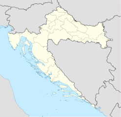
Géolocalisation sur la carte : Croatie

(Voir situation sur carte : Croatie)
Vozilići

Vozilići (en italien : Vosilla) est une localité de Croatie située en Istrie, dans la municipalité de Kršan, dans le comitat d'Istrie. En 2001, la localité comptait 248 habitants[1].

Sommaire

Démographie

Évolution démographique
1948 1953 1961 1971 1981 1991 2001
289 243 218 197 234 243 248[2]

Notes et références

  1. (en) Population by sex and age by settlements, census 2001 sur dzs.hr, Crostat - Bureau central de statistiques. Consulté le 7 juillet 2008
  2. (hr) Localités et population de la République de Croatie 1857.-2001. sur http://www.dzs.hr, Crostat - Bureau central de statistiques. Consulté le 19 octobre 2010

Voir aussi

Articles connexes


Wikimedia Foundation. 2010.

Contenu soumis à la licence CC-BY-SA. Source : Article Vozilići de Wikipédia en français (auteurs)

Игры ⚽ Нужно решить контрольную?

Regardez d'autres dictionnaires:

  • D64 road (Croatia) — D64 state road Route information Length: 26.9 km (16.7 mi) Major junctions …   Wikipedia

  • Kršan — Le village de Plomin dans la municipalité de Kršan Pays …   Wikipédia en Français

  • D66 road (Croatia) — D66 state road Route information Length: 90.1 km (56.0 mi) Major junctions …   Wikipedia

  • Gračišće — Infobox Settlement official name = Gračišće settlement type = Village image caption = Gračišće image shield = Gracisce.jpg pushpin map caption = Location of Gračišće in Croatia subdivision type = Country subdivision name = Croatia subdivision… …   Wikipedia

  • Kršan — ( it. Chersano) is a village and municipality in the central part of Istria, Croatia, 15 km north of Labin. The elevation is 50 m. The population is 3.264 (2001). The chief occupation is farming. Kršan is located on the regional road Vozilici… …   Wikipedia

  • Pićan — ( it. Pedena) is a village and municipality in the central part of Istria, Croatia, 12 km southeast of Pazin; elevation 360 m. Chief occupations are farming and livestock breeding. Situated on the regional road Pazin Kršan Vozilići. Railway… …   Wikipedia

  • Highways in Croatia — Map of the Croatian motorway network A6 int …   Wikipedia

  • Gracisce — Gračišće …   Deutsch Wikipedia

  • Gračišće — Gračišće …   Deutsch Wikipedia

  • Krsan — Kršan …   Deutsch Wikipedia

Share the article and excerpts

Direct link
Do a right-click on the link above
and select “Copy Link”