Vlakovo

Vlakovo

43° 52′ 35″ N 18° 14′ 24″ E / 43.8764, 18.2400

Vlakovo
Влаково
Administration
Pays Drapeau de Bosnie-Herzégovine Bosnie-Herzégovine
Entité Drapeau de la Fédération de Bosnie-et-Herzégovine Fédération de Bosnie-et-Herzégovine
Canton Sarajevo
Municipalité Ilidža
Géographie
Coordonnées 43° 52′ 35″ Nord
       18° 14′ 24″ Est
/ 43.8764, 18.2400
Démographie
Population hab. (1991)
Localisation
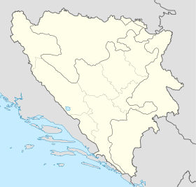
Bosnia and Herzegovina location map.svg
City locator 15.svg
Vlakovo

Vlakovo (en serbe cyrillique : Влаково) est un village de Bosnie-Herzégovine. Il est situé dans la municipalité d'Ilidža et dans le canton de Sarajevo, Fédération de Bosnie-et-Herzégovine. Au recensement de 1991, il comptait 2 habitants, tous les deux serbes[1].

Sommaire

Notes et références

  1. (bs)(hr)(sr) Livre : Composition nationale de la population - Résultats de la République par municipalités et localités 1991, Bulletin statistique n°234, Publication de l'Institut national de statistique de Bosnie-Herzégovine, Sarajevo.

Voir aussi

Articles connexes

Liens externes


Wikimedia Foundation. 2010.

Contenu soumis à la licence CC-BY-SA. Source : Article Vlakovo de Wikipédia en français (auteurs)

Игры ⚽ Нужно сделать НИР?

Regardez d'autres dictionnaires:

  • vlakovođa — vlȁkovođa m <N mn e> DEFINICIJA službenik koji upravlja vlakom za vrijeme putovanja ETIMOLOGIJA v. vlak + v. voditi, vođa …   Hrvatski jezični portal

  • Holiday home Vlakovo VI — (Stanišovi,Хорватия) Категория отеля: Адрес: 52220 Stanišovi, Хорватия …   Каталог отелей

  • A1 (Bosnien und Herzegowina) — Vorlage:Infobox hochrangige Straße/Wartung/BA A Autoput A1 in Bosnien und Herzegowina …   Deutsch Wikipedia

  • Ilidža (canton de Sarajevo) — Pour les articles homonymes, voir Ilidža. 43° 49′ 59″ N 18° 18′ 14″ E …   Wikipédia en Français

  • List of settlements in Bosnia and Herzegovina — This is a complete list of settlements in Bosnia and Herzegovina, as recorded by 1991 census, sorted by municipalities. Town of Sarajevo = Sarajevo Centar = • Mrkovići • Nahorevo• Poljine• Radava• Sarajevo (part of settlement)• Vića Sarajevo… …   Wikipedia

  • Europastraße 73 — Vorlage:Infobox hochrangige Straße/Wartung/EU E Europastraße 73 Karte …   Deutsch Wikipedia

  • Lists of cemeteries — These lists of cemeteries compile notable cemeteries, mausoleums, and other places people are buried worldwide. Reasons for notability include their design, their history, and their interments. Contents 1 Lists of cemeteries by country 1.1 Africa …   Wikipedia

  • Ilidža (cantón de Sarajevo) — Ilidžai Ilidža Organización territorial de la Federación de Bosnia y Herzegovina de Bosnia y Herzegovina …   Wikipedia Español

  • Buhotina — 43° 53′ 41″ N 18° 10′ 30″ E / 43.8947, 18.1750 …   Wikipédia en Français

  • Jasen (Ilidža) — Pour les articles homonymes, voir Jasen. 43° 45′ 27″ N 18° 20′ 53″ E …   Wikipédia en Français

Share the article and excerpts

Direct link
Do a right-click on the link above
and select “Copy Link”