Rakovica (Ilidža)

Rakovica (Ilidža)
Page d'aide sur l'homonymie Pour les articles homonymes, voir Rakovica.

43° 52′ 40″ N 18° 12′ 23″ E / 43.8778, 18.2064

Rakovica
Administration
Pays Drapeau de Bosnie-Herzégovine Bosnie-Herzégovine
Entité Drapeau de la Fédération de Bosnie-et-Herzégovine Fédération de Bosnie-et-Herzégovine
Canton Sarajevo
Municipalité Ilidža
Géographie
Coordonnées 43° 52′ 40″ Nord
       18° 12′ 23″ Est
/ 43.8778, 18.2064
Démographie
Population 1 374 hab. (1991)
Localisation
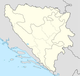
Bosnia and Herzegovina location map.svg
City locator 15.svg
Rakovica

Rakovica (en cyrillique : Раковица) est un village de Bosnie-Herzégovine. Il est situé dans la municipalité d'Ilidža et dans le canton de Sarajevo, Fédération de Bosnie-et-Herzégovine. Au recensement de 1991, il comptait 1 374 habitants, dont une majorité de Musulmans (Bosniaques)[1].

Sommaire

Démographie

Répartition de la population (1991)

Nationalité Nombre %
Musulmans 875 63,68
Serbes 393 28,60
Croates 60 4,36
Yougoslaves 39 2,83
Inconnus/autres 7 0,50[1]

En 1991, la communauté locale de Rakovica comptait 2 715 habitants, répartis de la manière suivante[2] :

Nationalité Nombre %
Musulmans 1 266 46,63
Serbes 1 099 40,48
Croates 242 8,91
Yougoslaves 89 3,28
Inconnus/autres 19 0,69

Notes et références

  1. a et b (bs)(hr)(sr) Livre : Composition nationale de la population - Résultats de la République par municipalités et localités 1991, Bulletin statistique n°234, Publication de l'Institut national de statistique de Bosnie-Herzégovine, Sarajevo.
  2. (bs)(hr)(sr)[PDF] Recensement par communautés locales sur http://www.fzs.ba, Bosnie-Herzégovine - Fédération de Bosnie-et-Herzégovine - Institut fédéral de statistique. Consulté le 11 octobre 2010

Voir aussi

Articles connexes

Liens externes


Wikimedia Foundation. 2010.

Contenu soumis à la licence CC-BY-SA. Source : Article Rakovica (Ilidža) de Wikipédia en français (auteurs)

Игры ⚽ Поможем сделать НИР

Regardez d'autres dictionnaires:

  • Rakovica, Bosnia and Herzegovina — Rakovica is a village in central eastern Bosnia and Herzegovina, located east of Ilidža and Sarajevo on the local road towards Kiseljak.Population was 2,721 in the 1991 census: 45% Bosniaks, 42% Serbs, 9% Croats and 3% Yugoslavs. Post war… …   Wikipedia

  • Ilidža (canton de Sarajevo) — Pour les articles homonymes, voir Ilidža. 43° 49′ 59″ N 18° 18′ 14″ E …   Wikipédia en Français

  • Rakovica — Cette page d’homonymie répertorie les différents sujets et articles partageant un même nom. Rakovica est un toponyme qui peut désigner : en  Bosnie Herzegovine !Bosnie Herzégovine Rakovica …   Wikipédia en Français

  • Ilidža (cantón de Sarajevo) — Ilidžai Ilidža Organización territorial de la Federación de Bosnia y Herzegovina de Bosnia y Herzegovina …   Wikipedia Español

  • Krupac (Ilidža) — Pour les articles homonymes, voir Krupac. 43° 46′ 34″ N 18° 21′ 50″ E …   Wikipédia en Français

  • Jasen (Ilidža) — Pour les articles homonymes, voir Jasen. 43° 45′ 27″ N 18° 20′ 53″ E …   Wikipédia en Français

  • Rudnik (Ilidža) — Pour les articles homonymes, voir Rudnik. 43° 52′ 24″ N 18° 10′ 59″ E …   Wikipédia en Français

  • Vela (Ilidža) — Pour les articles homonymes, voir Vela. 43° 54′ 34″ N 18° 11′ 04″ E …   Wikipédia en Français

  • Kobiljača (Ilidža) — Pour les articles homonymes, voir Kobiljača. 43° 52′ 55″ N 18° 11′ 38″ E …   Wikipédia en Français

  • List of Bosnia and Herzegovina-related topics — This is a list of topics related to Bosnia and Herzegovina. Those interested in the subject can monitor changes to the pages by clicking on Related changes in the sidebar.Bosnia and Herzegovina* Bosnia and Herzegovina * Republika Srpska*… …   Wikipedia

Share the article and excerpts

Direct link
Do a right-click on the link above
and select “Copy Link”