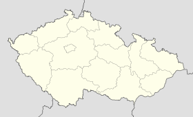
Vacov
Contenu soumis à la licence CC-BY-SA. Source : Article Vacov de Wikipédia en français (auteurs)
Regardez d'autres dictionnaires:
Vacov — can refer to:*Vác, a city in Hungary *Vacov, a village in the Czech Republic … Wikipedia
Vacov — Original name in latin Vacov Name in other language State code CZ Continent/City Europe/Prague longitude 49.13686 latitude 13.72911 altitude 731 Population 1372 Date 2006 11 25 … Cities with a population over 1000 database
Vacov (Prachatice District) — Geobox | Settlement name = Vacov other name = category = Village image caption = Vacov with St Nicholas church symbol = Vacov CZ CoA.svg etymology = official name = motto = nickname = country = Czech Republic country state = region = South… … Wikipedia
Liste der Naturschutzgebiete im Jihočeský kraj — Lage des Jihočeský kraj in Tschechien Die Liste der Naturschutzgebiete im Jihočeský kraj umfasst kleinflächige geschützte Gebiete in der Region Südböhmen, Tschechien. Aufgenommen sind alle offiziell ausgewiesenen Naturreservate und Naturdenkmäler … Deutsch Wikipedia
Vác — Infobox Settlement image caption = Vác Cathedral subdivision type = Country subdivision name = HUN timezone=CET utc offset=+1 timezone DST=CEST utc offset DST=+2 pushpin pushpin label position = pushpin map caption =Location of Vác pushpin… … Wikipedia
Nebahovy — Municipality … Wikipedia
Miřetice — is name of several locations in the Czech Republic: Miřetice, a village in Pardubice Region (Chrudim District) Miřetice, a village in Central Bohemian Region (Benešov District) village Miřetice u Klášterce nad Ohří, administrative part of town… … Wikipedia
Slovak exonyms — Below is a list of Slovak language exonyms for towns and villages in non Slovak speaking areas of the World : Caveat: some of them are only used in historical contexts today (not always marked in the list). A complete list of names that are… … Wikipedia
Netolice — Coordinates: 49°02′57″N 14°11′47″E / 49.04917°N 14.19639°E / 49.04917; 14.19639 … Wikipedia
Prachatice District — Okres Prachatice District Prachatice city … Wikipedia
 République tchèque
