Uppingham
- Uppingham
-
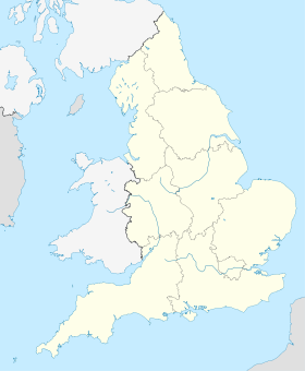
Uppingham est une ville du Royaume-Uni.
Wikimedia Foundation.
2010.
Contenu soumis à la licence CC-BY-SA. Source : Article Uppingham de Wikipédia en français (auteurs)
Regardez d'autres dictionnaires:
Uppingham — ist eine Gemeinde (civil parish) in der englischen Unitary Authority Rutland in der Region East Midlands. Im Jahr 2004 zählte sie 3.947 Einwohner.[1] Verkehr Die A Straße A 6003 führt durch Uppingham und verbindet den Ort mit Oakham im Norden und … Deutsch Wikipedia
Uppingham — (spr. öppingämm), Stadt in der engl. Grafsch. Rutland, (1901) 4939 E., alte Lateinschule (1581) … Kleines Konversations-Lexikon
Uppingham — Disambiguation: Uppingham is the colloquial name for Uppingham School infobox UK place country = England latitude= 52.5900 longitude= 0.7222 official name= Uppingham population = 3,781 unitary england= Rutland lieutenancy england= Rutland region … Wikipedia
Uppingham — Centro de la localidad de Uppingham. Uppingham es una localidad en el condado de Rutland en el East Midlands de Inglaterra, se encuentra ubicada a la vera de la carretera A47 entre Leicester y Peterborough, a unos 9 km al sur de la localidad de… … Wikipedia Español
Uppingham — ▪ England, United Kingdom town (parish) in the unitary authority and historic county of Rutland, England, noted for its 16th century houses and its public (independent secondary) school. It came into being as a market town and is located in … Universalium
Uppingham — Original name in latin Uppingham Name in other language State code GB Continent/City Europe/London longitude 52.58803 latitude 0.72272 altitude 150 Population 4035 Date 2011 03 03 … Cities with a population over 1000 database
Uppingham railway station — was a station in Uppingham, Rutland. It was the terminus of a branch line from Seaton and opened in 1894 and closed in 1960. Former Services Disused Rail StartReferences … Wikipedia
Uppingham School — Coordinates: 52°35′16″N 0°43′30″W / 52.58778°N 0.725°W / 52.58778; 0.725 … Wikipedia
Uppingham Rural District — infobox historic subdivision| Name= Uppingham HQ= Uppingham Status= Rural district Origin= Rural sanitary district Start= 1894 End= 1974 Replace= Rutland PopulationFirst= 6,809 PopulationFirstYear= 1901 AreaFirst= convert|24735|acre|km2… … Wikipedia
UPPINGHAM — market town in Rutland, with a famous public school … The Nuttall Encyclopaedia
 Royaume-Uni
