Trøgstad

Trøgstad
Trøgstad
Blason de Trøgstad

Blason de Trøgstad
Carte de Trøgstad

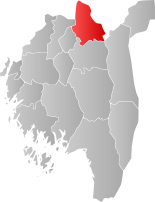
Localisation de Trøgstad dans le Østfold
Administration
Pays Drapeau de Norvège Norvège
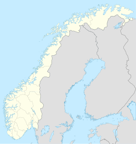
Région Østlandet
Comté Østfold
Centre administratrif Skjønhaug
Géographie
Coordonnées 59° 39′ Nord
       11° 18′ Est
/ 59.65, 11.3
Superficie 204,49 km²
Démographie
Population 5 039 hab. (2008)
Densité 24,64 hab./km²
Gentilé Trøgsting
Langue officielle Bokmål

  Géolocalisation sur la carte : Norvège

Norway location map.svg
Trøgstad

Trøgstad est une kommune de Norvège. Elle est située dans le comté d'Østfold et l'on y trouve un camping.

59°39′N 11°20′E / 59.65, 11.333


Wikimedia Foundation. 2010.

Contenu soumis à la licence CC-BY-SA. Source : Article Trøgstad de Wikipédia en français (auteurs)

Игры ⚽ Нужно решить контрольную?

Regardez d'autres dictionnaires:

  • Trøgstad — Escudo …   Wikipedia Español

  • Trøgstad — Wappen Karte Basisdaten Fylke: Østfold Region …   Deutsch Wikipedia

  • Trøgstad — Infobox Kommune name=Trøgstad idnumber=0122 county=Østfold landscape= capital=Skjønhaug governor=Tor Melvold (Ap) governor as of=2007 arearank=328 area=204 arealand=188 areapercent=0.06 population as of=2004 populationrank=193 population=4,953… …   Wikipedia

  • Trogstad — Admin ASC 2 Code Orig. name Trøgstad Country and Admin Code NO.13.0122 NO …   World countries Adminstrative division ASC I-II

  • Трёгстад — норв. Trøgstad   коммуна Норвегии   …   Википедия

  • Mysen — Wappen Karte …   Deutsch Wikipedia

  • NO-01 — Wappen Karte Basisdaten Land: Norwegen …   Deutsch Wikipedia

  • Öyeren — Øyeren Geographische Lage: Trøgstad, Spydeberg (Østfold); Fet, Rælingen, Enebakk (Akershus) Zuflüsse: Glomma Abflüsse: Glomma …   Deutsch Wikipedia

  • Коммуны Норвегии — Коммуны (норв. kommune, er …   Википедия

  • List of municipalities of Norway — Norway This article is part of the series: Politics and government of Norway …   Wikipedia

Share the article and excerpts

Direct link
Do a right-click on the link above
and select “Copy Link”