Tinje

Tinje

43° 31′ 18″ N 18° 11′ 03″ E / 43.5217, 18.1842

Tinje
Administration
Pays Drapeau de Bosnie-Herzégovine Bosnie-Herzégovine
Entité Drapeau de la Fédération de Bosnie-et-Herzégovine Fédération de Bosnie-et-Herzégovine
Canton Herzégovine-Neretva
Municipalité Konjic
Géographie
Coordonnées 43° 31′ 18″ Nord
       18° 11′ 03″ Est
/ 43.5217, 18.1842
Démographie
Population 75 hab. (1991)
Localisation
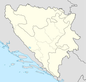
Bosnia and Herzegovina location map.svg
City locator 15.svg
Tinje

Tinje (en cyrillique : Тиње) est un village de Bosnie-Herzégovine. Il est situé dans la municipalité de Konjic et dans le canton d'Herzégovine-Neretva, Fédération de Bosnie-et-Herzégovine. Au recensement de 1991, il comptait 75 habitants, dont une majorité de Musulmans (Bosniaques)[1].

Tinje est situé sur le mont Visočica.

Sommaire

Démographie

Répartition de la population (1991)

Nationalité Nombre %
Musulmans 71 94,67
Serbes 4 5,33[1]

Notes et références

  1. a et b (bs)(hr)(sr) Livre : Composition nationale de la population - Résultats de la République par municipalités et localités 1991, Bulletin statistique n°234, Publication de l'Institut national de statistique de Bosnie-Herzégovine, Sarajevo.

Voir aussi

Articles connexes

Liens externes


Wikimedia Foundation. 2010.

Contenu soumis à la licence CC-BY-SA. Source : Article Tinje de Wikipédia en français (auteurs)

Игры ⚽ Нужна курсовая?

Regardez d'autres dictionnaires:

  • Tinje — Infobox Settlement name = Tinje other name = native name = nickname = settlement type = Municipality motto = imagesize = image caption = flag size = image seal size = image shield = shield size = image blank emblem = blank emblem type = blank… …   Wikipedia

  • tinje — (pronounced tinjay) a stereo My tinje has a cd player and a tape deck …   Dictionary of american slang

  • tinje — (pronounced tinjay) a stereo My tinje has a cd player and a tape deck …   Dictionary of american slang

  • Malo Tinje — Malo Tinje …   Wikipedia

  • Tainach — (slowenisch Tinje) ist ein Ort und eine Katastralgemeinde der Kärntner Großgemeinde Völkermarkt. Der 600 Einwohner (Stand 2001)[1] zählende Ort liegt etwa 10 Kilometer südwestlich des Stadtzentrums von Völkermarkt. Inhaltsverzeichnis 1 Geschichte …   Deutsch Wikipedia

  • Völkermarkt — Völkermarkt …   Deutsch Wikipedia

  • Vekoslav Grmič — (4 June 1923 21 March 2005) was a Slovene Catholic bishop and theologian.BiographyHe was born in the Lower Styrian village of Sveti Jurij ob Ščavnici in what was then the Kingdom of Serbs, Croats and Slovenes. He studied at a Roman Catholic… …   Wikipedia

  • Dolpo — Yak caravan near Saldang in the northern part of Dolpo. Dolpo (Tibetan: དོལ་པོ ) is a high altitude culturally Tibetan region in the upper part of the Dolpa District of western Nepal, bordered in the north by the Tibet Autonomous Region of Chin …   Wikipedia

  • Majevica — Elevation 916 m (3,005 ft) Location Location …   Wikipedia

  • Poggersdorf — Poggersdorf …   Deutsch Wikipedia

Share the article and excerpts

Direct link
Do a right-click on the link above
and select “Copy Link”