Tarlee
Contenu soumis à la licence CC-BY-SA. Source : Article Tarlee de Wikipédia en français (auteurs)
Regardez d'autres dictionnaires:
Tarlee, South Australia — Infobox Australian Place | type = town name = Tarlee state = sa caption = lga = District Council of Clare and Gilbert Valleys postcode = 5411 pop = est = region = Mid North mayor = Allan Aughey elevation= 246 maxtemp = mintemp = rainfall =… … Wikipedia
District Council of Clare and Gilbert Valleys — South Australia Location of District Council of Clare and Gilbert Valleys … Wikipedia
Giles Corner, South Australia — Infobox Australian Place | type = locality name = Giles Corner state = sa caption = Turnoff to the Barrier Highway, just south of Giles Corner lga = District Council of Clare and Gilbert Valleys postcode = 5411 pop = est = region = Mid North… … Wikipedia
Horace Nock — Horace Keyworth Nock (26 October 1879 ndash; 2 August 1958) was an Australian politician, farmer and company director. He was born at Salisbury, South Australia to Joseph Nock and his second wife Eliza, nee Keyworth.Nock attended Tarlee State… … Wikipedia
Bert Kelly — Charles Robert Bert Kelly CMG (22 December 1912 17 January 1997), [cite web title =Members of the House of Representatives since 1901 publisher =Parliament of Australia work=Parliamentary Handbook url… … Wikipedia
Barrier Highway — La Barrier Highway est un axe routier australien long de 1007 km situé en Nouvelle Galles du Sud et Australie Méridionale et signalé comme en Australie méridionale et en Nouvelle Galles du Sud … Wikipédia en Français
Jamison County — Map of all coordinates from Google Map of all coordinates from Bing Export all coordinates as KML … Wikipedia
Barrier Highway — Infobox Australian Road road name = Barrier Highway route route route photo = caption = length = 1007 direction = West East start = finish = est = through = Saddleworth, Burra, Peterborough, Yunta, Broken Hill, Wilcannia, Cobar route = Gawler… … Wikipedia
Aspendale, Victoria — Infobox Australian Place | type = suburb name = Aspendale city = Melbourne state = vic caption = lga = City of Kingston postcode = 3195 pop = 6404 (2006) Census 2006 AUS | id = SSC21035 | name = Aspendale (State Suburb) | accessdate = 2008 03 28… … Wikipedia
List of cities and towns in South Australia — This is a list of town and locality names in South Australia outside of the metropolitan postal area of Adelaide.:For a list of suburbs in metropolitan areas of Adelaide, see lists inside following individual city council articles: City of… … Wikipedia
 Australie
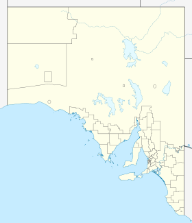
 Tarlee

