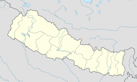
Tansen (Népal)
- Tansen (Népal)
-
Tansen (népalais : तानसेन) est une ville du Népal située dans la zone de Lumbinî et chef-lieu du district de Palpa. Au recensement de 2001, la ville comptait 20 431 habitants[1].
Notes et références
Wikimedia Foundation.
2010.
Contenu soumis à la licence CC-BY-SA. Source : Article Tansen (Népal) de Wikipédia en français (auteurs)
Regardez d'autres dictionnaires:
Tansen, Nepal — Infobox Settlement official name = Tansen other name = native name = motto = imagesize = image caption = flag size = image seal size = image shield = shield size = image blank emblem = blank emblem type = blank emblem size = mapsize = map caption … Wikipedia
Tansen — For the town in Nepal, see Tansen, Nepal. For the 1943 Bollywood film, see Tansen (film). Tansen Mia Tansen, a depiction by Lala Deo Lal, diplayed in Calcutta Gallery Background information … Wikipedia
Nepal — संघीय लोकतान्त्रिक गणतन्त्रात्मक नेपाल Saṃghīya Loktāntrik Gaṇatantrātmak Nepāl Demokratische Bundesrepublik Nepal[1] … Deutsch Wikipedia
Districts of Nepal — Nepal This article is part of the series: Politics and government of Nepal Government … Wikipedia
Demokratische Bundesrepublik Nepal — संघीय लोकतान्त्रिक गणतन्त्रात्मक नेपाल Saṃghīya Loktāntrik Gaṇatantrātmak Nepāl Demokratische Bundesrepublik Nepal[1] … Deutsch Wikipedia
Königreich Nepal — संघीय लोकतान्त्रिक गणतन्त्रात्मक नेपाल Saṃghīya Loktāntrik Gaṇatantrātmak Nepāl Demokratische Bundesrepublik Nepal[1] … Deutsch Wikipedia
Religion in Nepal — संघीय लोकतान्त्रिक गणतन्त्रात्मक नेपाल Saṃghīya Loktāntrik Gaṇatantrātmak Nepāl Demokratische Bundesrepublik Nepal[1] … Deutsch Wikipedia
Geography of Nepal — Continent Asia coordinates = 33°00 N 80°00 E Area Ranked 93rd 147,181 km2 (56,827 sq mi) 92.94% land 7.06 % water Borders Total land borders: 2,926 … Wikipedia
Districts Du Népal — Index alphabétique A B C D G H I J K L M … Wikipédia en Français
Districts du Nepal — Districts du Népal Index alphabétique A B C D G H I J K L M … Wikipédia en Français
 Vue panoramique de Tansen
 Népal
Népal
