Talmine
- Talmine
-
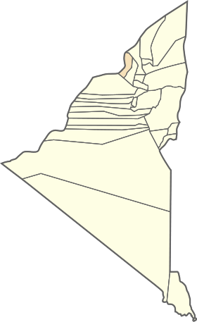
Talmine est une commune de la wilaya d'Adrar en Algérie.
Géographie
Situation
Cette section est vide,
insuffisamment détaillée ou incomplète.
Votre aide est la bienvenue !
Relief, géologie, hydrographie
Cette section est vide,
insuffisamment détaillée ou incomplète.
Votre aide est la bienvenue !
Transports
Cette section est vide,
insuffisamment détaillée ou incomplète.
Votre aide est la bienvenue !
Localités de la commune
En 1984, la commune de Talmine est constituée à partir des localités suivantes[2] :
- Boukezine
- Talmine
- Saguia
- Guettouf
- Takialt
- Taghouzi
- Naama
- Taarabien
|
- Tamesguelout
- Timarine
- Yahia Oudriss
- Bahmou
- Zaïtar
- Rached
- Taknout
- Gallou
|
Histoire
Cette section est vide,
insuffisamment détaillée ou incomplète.
Votre aide est la bienvenue !
Sources, notes et références
Voir aussi
Articles connexes
Liens externes
Wikimedia Foundation.
2010.
Contenu soumis à la licence CC-BY-SA. Source : Article Talmine de Wikipédia en français (auteurs)
Regardez d'autres dictionnaires:
Talmine — Tal minef weiblichePerson,andervielesoderallesunechtist.1935ff … Wörterbuch der deutschen Umgangssprache
Rabbit Islands, Scotland — The Rabbit Islands (coord|58.53|N|04.40|W|region:GB gbmappingsmall|NC602631)are a group of three uninhabited small islands off the north coast of Sutherland, Scotland in Tongue Bay. In Scottish Gaelic, and occasionally in English, they are known… … Wikipedia
Tongue — TONGUE, a parish, in the county of Sutherland, 250 miles (N. by W.) from Edinburgh; containing, with the island of Roan, and the villages of Tongue, Skianid, and Torrisdale, 2041 inhabitants, of whom 1558 are in the rural districts. This place … A Topographical dictionary of Scotland
Eilean nan Ròn — Infobox Scottish island | latitude=58.55 longitude= 4.34 GridReference=NC637656 celtic name=Eilean nan Ròn norse name= meaning of name=island of the seals area=138 ha area rank= 130= highest elevation= Cnoc an Loisgein 76 m Population=0… … Wikipedia
Adrar (Algérie) — Pour les articles homonymes, voir Adrar. Adrar Adrar, place des Martyrs Administration Nom algérien … Wikipédia en Français
Bouda (Algérie) — Bouda Ajouter une image Administration Nom algérien بودة Pays Algerie !Algérie … Wikipédia en Français
Communes de la wilaya d'Adrar — Pour les autres communes, voir Liste des communes d Algérie. La wilaya d Adrar est composée de 28 daïras et de 11 communes. Sommaire 1 Communes de la wilaya d Adrar 1.1 Localisation des communes dans la … Wikipédia en Français
Communes of Algeria — Algeria This article is part of the series: Politics and government of Algeria Constitution President (List … Wikipedia
Charouine — Charouine … Wikipedia
Metarfa — Metarfa … Wikipedia
 Algérie


