Tahmoor
Contenu soumis à la licence CC-BY-SA. Source : Article Tahmoor de Wikipédia en français (auteurs)
Regardez d'autres dictionnaires:
Tahmoor, New South Wales — Infobox Australian Place | type = town name = Tahmoor region = Macarthur state = New South Wales lga = Wollondilly Shire postcode = 2573 pop = 4339 (2001) stategov = Wollondilly fedgov = Hume near n = Picton near s = Bargo near w = Thirlmere near … Wikipedia
Tahmoor railway station, New South Wales — Cityrail Station alt|code=TAH|station name=Tahmoor| servicearea=Southern Highlands Line|servicearea color=#Southern Highlands line colour|servicearea textcolor=white town=Tahmoor|street=George St|distance=94.49|altitude=?|traintype=Intercity|platf… … Wikipedia
Tahmoor — /ˈtamɔ/ (say tahmaw) noun a town in south eastern NSW, north west of Wollongong; centre of a turkey production industry …
Bargo, New South Wales — Infobox Australian Place | type = town name = Bargo region = Macarthur state = New South Wales lga = Wollondilly Shire postcode = 2574 pop = 3942 [ [http://www.censusdata.abs.gov.au/ABSNavigation/prenav/ViewData?method=Place%20of%20Usual%20Residen… … Wikipedia
Brigades of the NSW RFS — Brigades of the New South Wales Rural Fire Service Listing by Rural Fire District [http://www.bluemountains.rfs.nsw.gov.au/ Blue Mountains District] * Bell * Blackheath / Mt Victoria * Blaxland * Bullaburra * Faulconbridge * Glenbrook Lapstone *… … Wikipedia
Couridjah, New South Wales — Couridjah New South Wales … Wikipedia
Wollondilly Anglican College — Infobox Secondary school name = Wollondilly Anglican College motto = For Christ s Glory established = 2004 type = Independent Anglican co educational primary and secondary school headmaster = Mr Stuart Quarmby deputy headmaster = Mr Ian Croger… … Wikipedia
Bargo River — Bargo RiverVorlage:Infobox Fluss/GKZ fehlt Lage New South Wales (Australien) Flusssystem Hawkesbury RiverVorlage:Infobox Fluss/FLUSSSYSTEM falsch Abfluss über … Deutsch Wikipedia
Hume Highway — Hume Freeway Proposed … Wikipedia
List of National Trust properties in Australia — This list includes any stately home, historic house, museum or other property in the care of the National Trust of Australia. Many, but not all, of these are open to the public.Australian Capital Territory*Lanyon Homestead (staffed by the Trust,… … Wikipedia
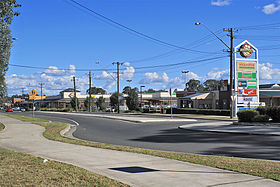 La grand'rue de Tahmoor
 Australie
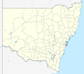
 Tahmoor


