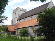
Streatley (Berkshire)
Contenu soumis à la licence CC-BY-SA. Source : Article Streatley (Berkshire) de Wikipédia en français (auteurs)
Regardez d'autres dictionnaires:
Streatley, Berkshire — infobox UK place country = England official name= Streatley latitude= 51.523 longitude= 1.15 population= 974 (2001 census data) civil parish= Streatley unitary england= West Berkshire lieutenancy england=Berkshire region= South East England… … Wikipedia
Streatley — may refer to: * Streatley, Bedfordshire * Streatley, Berkshire … Wikipedia
Goring & Streatley railway station — Goring Streatley Goring Streatley railway station, with a Virgin Voyager train passi … Wikipedia
Goring and Streatley Bridge — Goring and Streatley Bridge) Goring and Streatley Bridge on the Goring side from Goring Lock Carries B4009 Crosses River Thames Locale … Wikipedia
List of places in Berkshire — This is a list of settlements in Berkshire, England. See the list of places in England for places in other counties. Many of the settlements listed here are , and any red links represent settlements that currently do not have enough knowledge… … Wikipedia
Newbury, Berkshire — Coordinates: 51°24′03″N 1°19′25″W / 51.4009°N 1.3235°W / 51.4009; 1.3235 … Wikipedia
Goring and Streatley — are twin villages, in the English counties of Oxfordshire and Berkshire respectively, separated by the River Thames and joined by Goring and Streatley Bridge. The villages are sometimes treated as one (for example in the naming of the local… … Wikipedia
West Berkshire — District Location of West Berkshire in Berkshire Geography Status: Unitary authority Region: South East England … Wikipedia
Compton, Berkshire — Coordinates: 51°30′54″N 1°15′11″W / 51.515°N 1.253°W / 51.515; 1.253 … Wikipedia
Donnington, Berkshire — Coordinates: 51°25′05″N 1°19′52″W / 51.418°N 1.331°W / 51.418; 1.331 … Wikipedia

