- Shikaoi
-
Shikaoi-chō (鹿追町) 
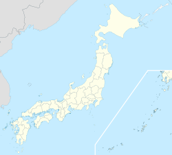
Paysage de Shikaoi en hiver.Administration Pays Japon Région Hokkaidō Préfecture Hokkaidō Code postal 〒081-0292 Site web Site officiel Démographie Population 5 697 hab. (juin 2011) Densité 14 hab./km2 Géographie Coordonnées Superficie 402,86 km2 Géolocalisation sur la carte : Japon

Shikaoi (鹿追町, Shikaoi-chō?) est un bourg situé dans le district de district de Katō, Tokachi, Hokkaidō, Japon. Le nom « Shikaoi » signifie « À la suite [chasse], des cerfs ». En 2011, le bourg a une population estimée à 5 697 et une densité de 14,1 personnes par km².
Histoire
Les débuts de Shikaoi remontent à 1902, lorsque M. Yamada de Tōkyō s’est installé dans ce qui est aujourd'hui la rue principale de Shikaoi. En 1913, une gare a ouvert le flux de colons de Honshū. Peu de temps après, des restaurants, un bureau de poste, un poste de police ont vu le jour. En 1920, la population de Shikaoi était de 4526 personnes (822 familles). En avril 1921, il devint le village Shikaoi. La ligne de chemin de fer a été posée en 1923 pour assurer le transport des betteraves de la région. En outre, les marchandises diverses et le transport de passagers ont été autorisés en mai 1925. Un grand rôle a été joué pour le développement industriel de Shikaoi par le reclassement du réseau routier et de chemins de fer. La population a augmenté rapidement à cause de l’implantation d’une caserne après la Première Guerre mondiale (10 448 personnes, 1970 familles dans le recensement de 1960). La région Shikaoi et la commune de Shikaoi se sont réunies en 1959.
Après un pic de population (10 778 personnes) en 1961, elle a diminué progressivement à cause des dommages du froid sur l'agriculture. Mais après 1993, elle est devenue stable avec beaucoup d'efforts, y compris une agriculture modernisée, capable de résister aux éléments.
Notes et références
Catégories :- Municipalité de la préfecture de Hokkaidō
- Bourg du Japon


Wikimedia Foundation. 2010.