Seregélyes
- Seregélyes
-
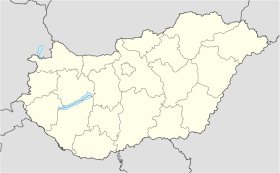
Seregélyes est un village et une commune du comitat de Fejér en Hongrie.
Géographie
Cette section est vide, insuffisamment détaillée ou incomplète.
Votre aide est la bienvenue !
Histoire
Cette section est vide, insuffisamment détaillée ou incomplète.
Votre aide est la bienvenue !
Catégorie :
- Ville et village du comitat de Fejér
Wikimedia Foundation.
2010.
Contenu soumis à la licence CC-BY-SA. Source : Article Seregélyes de Wikipédia en français (auteurs)
Regardez d'autres dictionnaires:
Seregēlyes — Seregēlyes, Marktflecken im ungarischen Bezirk u. Comitat Stuhlweißenburg; Schloß mit Park, Weberei, 4 Jahrmärkte, Ziegelbrennerei; 3500 Ew … Pierer's Universal-Lexikon
Seregélyes — Infobox Settlement subdivision type = Country subdivision name = HUN timezone=CET utc offset=+1 timezone DST=CEST utc offset DST=+2 pushpin pushpin label position = pushpin map caption =Location of Seregélyes pushpin mapsize = official… … Wikipedia
Seregelyes — Original name in latin Sereglyes Name in other language Seregelyes, Sereglyes State code HU Continent/City Europe/Budapest longitude 47.1105 latitude 18.565 altitude 121 Population 4539 Date 2012 05 06 … Cities with a population over 1000 database
Seregélyes — Sp Šèregėješas Ap Seregélyes L Vengrija … Pasaulio vietovardžiai. Internetinė duomenų bazė
Ferenc Münnich — Infobox President | name= Ferenc Münnich nationality=Hungarian order=Chairman of the Council of Ministers of the People s Republic of Hungary term start=January 28,1958 term end=September 13,1961 predecessor=János Kádár successor=János Kádár… … Wikipedia
Fejer — Dieser Artikel behandelt das ungarische Komitat Fejér, für den ungarischen Mathematiker siehe Leopold Fejér, für Informationen zum historischen Komitat siehe Komitat Weißenburg. Koordinaten fehlen! Hilf mit. Fejér … Deutsch Wikipedia
Fejér — 47°10′0″N 18°35′0″E / 47.16667, 18.58333 … Wikipédia en Français
Fejér County — Infobox Hungarian county name =Fejér region =Central Transdanubia seat = Székesfehérvár area = 4359 population = 426,541 density = 98 cities = 108: For the historical county see Fejér (former county). : For the mathematician of the same name see… … Wikipedia
Dunaújváros — The bridge on the Danube … Wikipedia
Mór — For other uses, see Mór (disambiguation). Mór Lamberg Castle, Mór … Wikipedia

 Hongrie


