Salamatof (Alaska)
- Salamatof (Alaska)
-
60° 35′ 36″ N 151° 18′ 38″ W / 60.593333, -151.310556
Salamatof est une ville d'Alaska (CDP) aux États-Unis, appartenant au Borough de la péninsule de Kenai. Sa population était de 980 habitants en 2010.
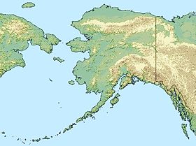
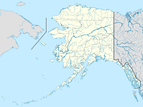
Elle est située sur la Péninsule Kenai, sur la rive est du golfe de Cook, à l'embouchure de la rivière Salamatof, à 5,5 milles (9 km) de Kenai.
Les températures moyennes vont de 4 degrés Fahrenheit (-16 °C) à 22 degrés Fahrenheit (-6 °C) en janvier et de 46 degrés Fahrenheit (8 °C) à 65 degrés Fahrenheit (18 °C) en juillet.
La localité a été référencée pour la première fois en 1911 par l'United States Geological Survey comme étant un village Dena'ina. Actuellement, une grande partie de la population fait partie du peuple Athabaskan.
L'économie locale est diversifiée, pêche, exploitation de bois d'œuvre et du pétrole, tourisme.
Articles connexes
Notes et références
Wikimedia Foundation.
2010.
Contenu soumis à la licence CC-BY-SA. Source : Article Salamatof (Alaska) de Wikipédia en français (auteurs)
Regardez d'autres dictionnaires:
Salamatof, Alaska — Salamatof is a census designated place (CDP) in Kenai Peninsula Borough, Alaska, United States. The population was 954 at the 2000 census.GeographySalamatof is located at coor dms|60|35|36|N|151|18|38|W|city (60.593250, 151.310547)GR|1.According… … Wikipedia
Alaska locations by per capita income — Alaska has the fourteenth highest per capita income in the United States of America, at $22,660 (2000). Its personal per capita income is $33,568 (2003), the twelfth highest in the country. Its median household income is $51,571 (2000), ranked… … Wikipedia
Salamatof — Salamatof, AK U.S. Census Designated Place in Alaska Population (2000): 954 Housing Units (2000): 282 Land area (2000): 8.108753 sq. miles (21.001574 sq. km) Water area (2000): 0.140387 sq. miles (0.363600 sq. km) Total area (2000): 8.249140 sq.… … StarDict's U.S. Gazetteer Places
Salamatof, AK — U.S. Census Designated Place in Alaska Population (2000): 954 Housing Units (2000): 282 Land area (2000): 8.108753 sq. miles (21.001574 sq. km) Water area (2000): 0.140387 sq. miles (0.363600 sq. km) Total area (2000): 8.249140 sq. miles… … StarDict's U.S. Gazetteer Places
Nanwalek, Alaska — CDP Location of Nanwalek (AKA English Bay, Alaska) … Wikipedia
Ninilchik, Alaska — CDP Ninilchik Village … Wikipedia
National Register of Historic Places listings in Kenai Peninsula Borough, Alaska — Location of the Kenai Peninsula Borough in Alaska This is a list of the National Register of Historic Places listings in Kenai Peninsula Borough, Alaska. This is intended to be a complete list of the properties and districts on the National… … Wikipedia
Miller Landing, Alaska — CDP A view of Miller s Landing on Kachemak Bay … Wikipedia
Nikolaevsk, Alaska — This article is about a CDP in Alaska. For other uses, see Nikolayevsk (disambiguation). Nikolaevsk, Alaska CDP … Wikipedia
Kenai Peninsula Borough, Alaska — Infobox U.S. County county = Kenai Peninsula Borough state = Alaska founded = seat = Soldotna | area total sq mi =16013 area water sq mi =8741 area percentage = 35.31% census yr = 2000 pop = 49691 density km2 =1 web = www.borough.kenai.ak.us… … Wikipedia
 États-Unis
 Alaska


