- Région de Goyder
-
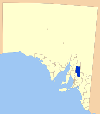
Région de Goyder 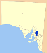
Localisation de la LGADonnées générales Pays  Australie
État ou Territoire Australie-Méridionale Région Mid North Superficie 6 719 km² Population 4 185 hab. (2006) Densité 0,62 hab./km² Administration Nom du Conseil Conseil de la région de Goyder Siège du Conseil Burra Maire Peter Mattey Site web http://www.goyder.sa.gov.au/ modifier 
La région de Goyder est une zone d'administration locale au nord d'Adélaïde en Australie-Méridionale en Australie.
Localités
La principale localité de la région est Burra.
Les autres sont: Aberdeen, Apoinga, Australia Plain, Baldina, Baldry, Booborowie, Bower, Brady Creek, Braemar (Station), Bright, Brownlow, Buchanan, Bundey, Burra, Burra Eastern Districts, Burra North, Canowie, Canowie Belt, Collinsville, Copperhouse, Deep Creek, Dutton, Emu Downs (Hill), Eudunda, Farrell Flat, Franklyn, Frankton, Geranium Plains, Gum Creek, Hallelujah Hills, Hallet, Hampden, Hansborough, Hanson, Julia, Ketchowla, Koonoona, Kooringa, Leighton, Mallet (Reservoir), Mongolata, Mount Bryan, Neales, Neath Vale, Ngapala, North Booborwie, Pandappa, Peep Hill, Point Pass, Porter Lagoon, Robertstown, Rocky Plain, Steinfeld, Sutherlands, Terowie, Thistle Beds, Tracy, Ulooloo, Whyte-Yarcowie, Willalo, Worlds End, Worlds End Creek, Yarcowie et Yongala Vale.
Références
Catégorie :- Zone d'administration locale d'Australie-Méridionale
Wikimedia Foundation. 2010.