Rakite

Rakite

43° 46′ 26″ N 18° 39′ 59″ E / 43.7739, 18.6664

Rakite
Раките
Administration
Pays Drapeau de Bosnie-Herzégovine Bosnie-Herzégovine
Entité Drapeau de la république serbe de Bosnie République serbe de Bosnie
Municipalité Pale
Géographie
Coordonnées 43° 46′ 26″ Nord
       18° 39′ 59″ Est
/ 43.7739, 18.6664
Démographie
Population 13 hab. (1991)
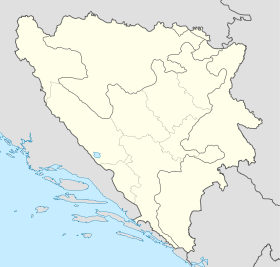
Localisation
Bosnia and Herzegovina location map.svg
City locator 15.svg
Rakite

Rakite (en serbe cyrillique : Раките) est un village de Bosnie-Herzégovine. Il est situé dans la municipalité de Pale, République serbe de Bosnie. Au recensement de 1991, il comptait 13 habitants, tous serbes[1].

Sommaire

Notes et références

  1. (bs)(hr)(sr) Livre : Composition nationale de la population - Résultats de la République par municipalités et localités 1991, Bulletin statistique n°234, Publication de l'Institut national de statistique de Bosnie-Herzégovine, Sarajevo.

Voir aussi

Articles connexes

Liens externes


Wikimedia Foundation. 2010.

Contenu soumis à la licence CC-BY-SA. Source : Article Rakite de Wikipédia en français (auteurs)

Игры ⚽ Нужно сделать НИР?

Regardez d'autres dictionnaires:

  • Pale (Bosnie-Herzégovine) —  Pour l’article homonyme, voir Pale.  43° 48′ 58″ N 18° 34′ 10″ E …   Wikipédia en Français

  • FK Bokelj — Football club infobox clubname = FK Bokelj Kotor fullname = Fudbalski klub Bokelj Kotor nickname = Beštije (The Beasts) founded = ground = Stadion pod Vrmcem Kotor, Montenegro capacity = 5.000 chairman = Jovica Vujović manager = Aleksandar… …   Wikipedia

  • List of settlements in Bosnia and Herzegovina — This is a complete list of settlements in Bosnia and Herzegovina, as recorded by 1991 census, sorted by municipalities. Town of Sarajevo = Sarajevo Centar = • Mrkovići • Nahorevo• Poljine• Radava• Sarajevo (part of settlement)• Vića Sarajevo… …   Wikipedia

  • Bosnische Ostbahn — Streckenführung der bosnischen Ostbahn. Links unten die Narentabahn nach Mostar, links oben die Bosnabahn nach Bosanski Brod, rechts die serbische Strecke nach Užice, Belgrad Die Bosnische Ostbahn war eine Schmalspurbahn mit der Spurweite… …   Deutsch Wikipedia

  • Kiseljak — Кисељак …   Deutsch Wikipedia

  • Pale (Bosnie-Herzegovine) — Pale (Bosnie Herzégovine)  Pour l’article homonyme, voir Pale.  Pale Пaле [[Image:|100px|center|Blason]] [[Image:|100px|center|Drapeau]] …   Wikipédia en Français

  • Pale (bosnie-herzégovine) —  Pour l’article homonyme, voir Pale.  Pale Пaле [[Image:|100px|center|Blason]] [[Image:|100px|center|Drapeau]] …   Wikipédia en Français

  • Matayos — Matayos …   Wikipedia

  • Bjelogorci (Pale) — Pour les articles homonymes, voir Bjelogorci. 43° 53′ 32″ N 18° 33′ 25″ E …   Wikipédia en Français

  • Bljuštevac — 43° 53′ 16″ N 18° 36′ 15″ E / 43.8878, 18.6042 …   Wikipédia en Français

Share the article and excerpts

Direct link
Do a right-click on the link above
and select “Copy Link”