Poseyville
Contenu soumis à la licence CC-BY-SA. Source : Article Poseyville de Wikipédia en français (auteurs)
Regardez d'autres dictionnaires:
Poseyville — Poseyville, IN U.S. town in Indiana Population (2000): 1187 Housing Units (2000): 490 Land area (2000): 0.663806 sq. miles (1.719250 sq. km) Water area (2000): 0.000000 sq. miles (0.000000 sq. km) Total area (2000): 0.663806 sq. miles (1.719250… … StarDict's U.S. Gazetteer Places
Poseyville, IN — U.S. town in Indiana Population (2000): 1187 Housing Units (2000): 490 Land area (2000): 0.663806 sq. miles (1.719250 sq. km) Water area (2000): 0.000000 sq. miles (0.000000 sq. km) Total area (2000): 0.663806 sq. miles (1.719250 sq. km) FIPS… … StarDict's U.S. Gazetteer Places
Poseyville — Original name in latin Poseyville Name in other language State code US Continent/City America/Chicago longitude 38.17004 latitude 87.78308 altitude 134 Population 1045 Date 2011 05 14 … Cities with a population over 1000 database
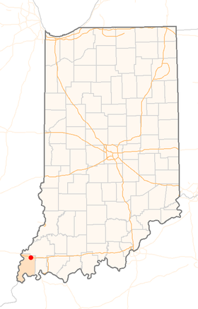
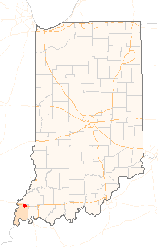
Poseyville, Indiana — Infobox Settlement official name = Town of Poseyville native name = settlement type = Town nickname = motto = imagesize = image caption = image imagesize = image caption = image mapsize = 250x200px map caption = Location in the state of Indiana… … Wikipedia
47633 — Poseyville, In (Miscellaneous » ZIP Codes) … Abbreviations dictionary
North Posey High School — Location Poseyville, Indiana, USA Information Type Public high school Established 1959 Principal Scott Strieter … Wikipedia
Indiana State Road 165 — Infobox road state=IN type=IN route=165 alternate name= length mi=17.2 length round=1 length ref= [http://illi indi.com/EndsPage.php?id=1165 section=1 Indiana Highway Ends SR 165] ] established= direction a=South starting terminus= junction=… … Wikipedia
Posey County, Indiana — Infobox U.S. County county = Posey County state = Indiana founded year = 1814 founded date = seat wl = Mount Vernon largest city wl = Mount Vernon area total sq mi = 419 area total km2 = 1086 area land sq mi = 408 area land km2 = 1058 area water… … Wikipedia
Mount Vernon, Indiana — City of Mount Vernon City … Wikipedia
New Harmony, Indiana — Town Location in the state of … Wikipedia
 États-Unis
 Indiana