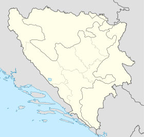
Popovo Polje
- Popovo Polje
-
44° 47′ 47″ N 18° 55′ 47″ E / 44.7964, 18.9297
Popovo Polje (en serbe cyrillique : Попово Поље) est un village de Bosnie-Herzégovine. Il est situé dans le district de Brčko. Au recensement de 1991, il comptait 248 habitants, dont une majorité de Serbes[1].
Démographie
Répartition de la population (1991)
Notes et références
- ↑ a et b (bs)(hr)(sr) Livre : Composition nationale de la population - Résultats de la République par municipalités et localités 1991, Bulletin statistique n°234, Publication de l'Institut national de statistique de Bosnie-Herzégovine, Sarajevo.
Voir aussi
Articles connexes
Liens externes
Catégories : - Localité de Brčko
- Localité de Brčko à majorité serbe
Wikimedia Foundation.
2010.
Contenu soumis à la licence CC-BY-SA. Source : Article Popovo Polje de Wikipédia en français (auteurs)
Regardez d'autres dictionnaires:
Popovo polje — Pòpovō pȍlje sr <G Pòpovā pȍlja> DEFINICIJA geogr. krško polje u JI Hercegovini, 46 km2 ONOMASTIKA v. pop1 … Hrvatski jezični portal
Popovo polje — Sp Pòpovo Pòlė Ap Popovo polje L žem. Bosnijoje ir Hercegovinoje … Pasaulio vietovardžiai. Internetinė duomenų bazė
Popovo Valley — Popovo Polje (Translation: Priest s field) is a valley in Herzegovina, famous for its karst landscape. The Trebišnjica River flows through the valley. To the south of the valley is the Vjetrenica cave system, the reaches cave fauna places at… … Wikipedia
Polje — Feneos Ebene, Peloponnes, 710 m, 4/2006; Polje mit 4 Ponoren (am Bergsaum) Polje (kroat./serb./bosn./slow.: Feld, Plural: Polja) ist ein aus dem dinarischen Karst übernommener geomorphologischer Fachbegriff für eine Karstverebnung, die an… … Deutsch Wikipedia
Polje — A polje is a large flat plain in karst territory with areas usually 5 to 400 km². The name derives from the word for field in Slovenian language.They are mostly distributed in subtropical and tropical latitudes but some also appear in temperate… … Wikipedia
Popovo Polė — Sp Pòpovo Pòlė Ap Popovo polje L žem. Bosnijoje ir Hercegovinoje … Pasaulio vietovardžiai. Internetinė duomenų bazė
Brezovo Polje (Brčko) — Pour les articles homonymes, voir Brezovo Polje. 44° 49′ 06″ N 18° 56′ 10″ E … Wikipédia en Français
Brezovo Polje (selo) — Pour les articles homonymes, voir Brezovo Polje. 44° 50′ 39″ N 18° 57′ 17″ E … Wikipédia en Français
Marković Polje — 44° 55′ 15″ N 18° 42′ 10″ E / 44.9208, 18.7028 … Wikipédia en Français
Trebisnjica — Die Trebišnjica im Zentrum von Trebinje Die Trebišnjica (kyrillisch Требишњица) ist ein Fluss in Bosnien und Herzegowina, Montenegro und Kroatien, der 98 km oberirdisch und weitere 89 km unterirdisch verläuft. Die Trebišnjica fließt durch die… … Deutsch Wikipedia
 Bosnie-Herzégovine
