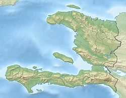
Pic de Macaya
Contenu soumis à la licence CC-BY-SA. Source : Article Pic de Macaya de Wikipédia en français (auteurs)
Regardez d'autres dictionnaires:
Pic la Selle — Géographie Altitude 2 680 m[1] Massif … Wikipédia en Français
Pic Macaya — (Macaya Peak) is the second highest mountain in Haiti (after Pic la Selle) and the fifth highest in the Caribbean, rising to an elevation of 2,347 meters (7,700 feet) above sea level.The mountain is located in the Pic Macaya National Park … Wikipedia
Pic Macaya National Park — Parc National Pic Macaya ( Pic Macaya National Park ) is one of two national parks of the Republic of Haiti. It is located in the southern part of the country, and features the country s last stand of virgin cloud forest. Elevations in the rugged … Wikipedia
Parc national de Macaya — Catégorie UICN II (parc national) Identifiant 7879 Pays … Wikipédia en Français
Massif de la Hotte — 18°22′59″N 74°1′32″O / 18.38306, 74.02556 … Wikipédia en Français
Géographie d'Haïti — Continent Amérique Région Caraïbes Coordonnées 19°00 N, 72°25 W Superficie 143e ra … Wikipédia en Français
Morne Bois-Pins — Géographie Altitude 2 235 m Massif Chaîne de la Selle Coordonnées … Wikipédia en Français
Morne du Cibao — Géographie Altitude 2 280 m Massif Chaîne de la Selle Coordonnées … Wikipédia en Français
Péninsule de Tiburon (Haïti) — Pour les articles homonymes, voir Péninsule de Tiburon. Péninsule de Tiburon Carte d Haïti avec la péninsule de Tiburon (en bas) … Wikipédia en Français
Mountain peaks of the Caribbean — Main article: Caribbean Sea See also: Mountain peaks of North America Contents 1 Highest major summits 2 Most prominent summits … Wikipedia

 Haïti
Haïti

