Nggatokae
- Nggatokae
-
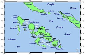
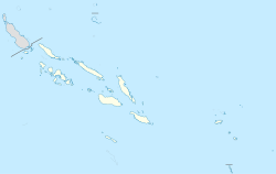
Nggatokae est une île située dans la province occidentale des îles Salomon.
D'une superficie de 93 km², son sommet le plus long est le mont Mariu qui culmine à 887 m.
Elle est située au sud-est de Vangunu.
Wikimedia Foundation.
2010.
Contenu soumis à la licence CC-BY-SA. Source : Article Nggatokae de Wikipédia en français (auteurs)
Regardez d'autres dictionnaires:
Nggatokae — Vorlage:Infobox Insel/Wartung/Höhe fehlt Nggatokae Die Inselgruppe des New Georgia Archipels Gewässer … Deutsch Wikipedia
Nggatokae Island — New Georgia Islands Nggatokae Island is an island in the New Georgia Islands group of Solomon Islands. It is an extinct volcano, the highest peak is Mount Mariu (887 m.). The island has an area of 93 km2, and a population of 2,367 (1999 census) … Wikipedia
New Georgia Islands — Solomon Islands New Georgia Islands The … Wikipedia
New Georgia — Islands with main centres Geography … Wikipedia
Duff Islands — The Duff Islands (Pileni Taumako) are a small island group lying to the northeast of the Santa Cruz Islands in the Solomon Islands province of Temotu. They are also sometimes known as the Wilson Islands … Wikipedia
Tikopia — NASA picture of Tikopia. Tikopia is a small and high island in the southwestern Pacific Ocean. Covering an area of 5 km² (2 sq. mi.), the island is the remnant of an extinct volcano. Its highest point, Mt. Reani, reaches an elevation of… … Wikipedia
Makira — For other uses, see Makira (disambiguation). Makira Makira and nearby islands Location of Makira in Solomon Islands … Wikipedia
Western Province (Solomon Islands) — Infobox Solomon Islands Province name = Western Province capital = Gizo area = 5,475 arearank = 1st population = 62,739 population as of = 1999 populationrank = 2nd density = 11.5 densityrank = 4th isocode = footnotes = map Western Province is… … Wikipedia
South Malaita Island — Maramasike and neighbouring areas South Malaita Island, also known as Small Malaita and Maramasike, is a large island at the southern tip of the larger island of Malaita in the eastern part of the Solomon Islands. It is called small to… … Wikipedia
Malaita — Island seen from space (false color) Geography Locati … Wikipedia
 Salomon
 Salomon

