Nagyhegyes
- Nagyhegyes
-
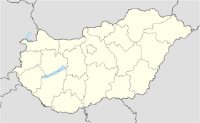
Nagyhegyes est un village et une commune du comitat de Hajdú-Bihar en Hongrie.
Géographie
Cette section est vide,
insuffisamment détaillée ou incomplète.
Votre aide est la bienvenue !
Histoire
Cette section est vide,
insuffisamment détaillée ou incomplète.
Votre aide est la bienvenue !
Catégorie : - Ville et village du comitat de Hajdú-Bihar
Wikimedia Foundation.
2010.
Contenu soumis à la licence CC-BY-SA. Source : Article Nagyhegyes de Wikipédia en français (auteurs)
Regardez d'autres dictionnaires:
Nagyhegyes — Country Hungary County Hajdú Bihar Area – Total 132.76 km2 (51.3 s … Wikipedia
Debrecen — Debrecen … Wikipedia
Găneşti — Roumanie Judeţ de Mureş Găneşti Statut : Commune … Wikipédia en Français
Hajdú-Bihar County — Infobox Hungarian county name =Hajdú Bihar region =Northern Great Plain seat = Debrecen area = 6211 population = 543,800 density = 87 cities = 82Hajdú Bihar is an administrative county (comitatus or megye) in eastern Hungary, on the border with… … Wikipedia
Csökmő — Country Hungary County Hajdú Bihar Area – Total 68.97 km2 (26.6 sq� … Wikipedia
Derecske — Country Hungary County Hajdú Bihar Area Total 103.58 km2 (40 sq� … Wikipedia
Nagykereki — Nagykereki … Wikipedia
Magyarhomorog — Country Hungary County Hajdú Bihar Area Total 39.56 km2 (15.3 … Wikipedia
Darvas — For the Romanian village of Dărvaş, see Bujoreni, Teleorman. Darvas Country Hungary County Hajdú Bihar Area … Wikipedia
Nádudvar — Country Hungary County Hajdú Bihar Area – Total 225.91 km2 (87.2 sq&# … Wikipedia

 Hongrie


