Longwarry
- Longwarry
-
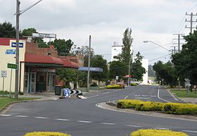
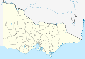
Longwarry (626 habitants) est un village du Gippsland de l'État du Victoria, en Australie. Il est situé à 83km au sud-est de Melbourne. Il est contourné par la Princes Highway.
Références
Sur les autres projets Wikimedia :
Wikimedia Foundation.
2010.
Contenu soumis à la licence CC-BY-SA. Source : Article Longwarry de Wikipédia en français (auteurs)
Regardez d'autres dictionnaires:
Longwarry, Victoria — Infobox Australian Place | type = town name = Longwarry state = vic caption = lga = Shire of Baw Baw postcode = 3816 pop = 1,187 (2006) est = maxtemp = mintemp = rainfall = fedgov = Division of McMillan dist1 = 83 location1= Melbourne dist2 = 9… … Wikipedia
Longwarry railway station, Victoria — VlineRailwayStation1 NAME=Longwarry IMAGELINK=LongwarryStation1.jpg CAPTION=The station before the overhead wires were removed CODE=LWY DISTANCE=82.26 km LINES=Bairnsdale PLATFORMS=1 TRACKS=1 STATUS=Unmanned Station FACILITIES=… … Wikipedia
List of localities in Victoria (Australia) — Map of Local Government Areas in Victoria This is a list of locality names and populated place names in the state of Victoria, Australia, outside the Melbourne metropolitan area. It is organised by region from the south west of the state to the… … Wikipedia
Bunyip railway station, Victoria — VlineRailwayStation1 NAME=Bunyip CODE=BYP DISTANCE=77.86 km LINES=Bairnsdale PLATFORMS=1 TRACKS=1 STATUS=Unmanned Station FACILITIES= [http://www.viclink.com.au/stop/view/20299 Link] TIMETABLES= [http://www.viclink.com.au/stop/view/20299 Link]… … Wikipedia
Drouin, Victoria — Drouin Victoria Main street … Wikipedia
Shire of Buln Buln — Infobox Australian Place | type = lga name = Shire of Buln Buln state = vic region = area = 1259 est = 1878 seat = Drouin pop = 11960 (1992) [cite book|title=Victorian Year Book|author=Australian Bureau of Statistics, Victoria… … Wikipedia
Baw Baw Shire — Lage des Baw Baw Shire in Victoria Gliederung … Deutsch Wikipedia
Shire of Baw Baw — Baw Baw Shire Lage des Baw Baw Shire in Victoria Basisdaten Bundesstaat: Victoria Hauptort: Warragul Fläche: 3.855 … Deutsch Wikipedia
Shire of Cardinia — Infobox Australian Place | type = lga name = Shire of Cardinia state = vic caption = pop = 57,115 (2006)Census 2006 AUS|id=LGA21450|name=Cardinia (S) (Local Government Area)|accessdate=2007 12 24|quick=on] area = 1280.6 est = 1994 seat = Pakenham … Wikipedia
Shire of Baw Baw — Infobox Australian Place | type = lga name = Shire of Baw Baw state = vic caption = Location in Victoria pop = 37,179 (2006 Census) area = 4031 est = 1994 seat = Warragul mayor = Dick Van Leeuwen region = Gippsland url =… … Wikipedia
 La grand'rue de Longwarry
 Australie

