Lišci

Lišci

44° 07′ 17″ N 18° 39′ 35″ E / 44.1214, 18.6597

Lišci
Administration
Pays Drapeau de Bosnie-Herzégovine Bosnie-Herzégovine
Entité Drapeau de la Fédération de Bosnie-et-Herzégovine Fédération de Bosnie-et-Herzégovine
Canton Zenica-Doboj
Municipalité Olovo
Géographie
Coordonnées 44° 07′ 17″ Nord
       18° 39′ 35″ Est
/ 44.1214, 18.6597
Démographie
Population 291 hab. (1991)
Localisation
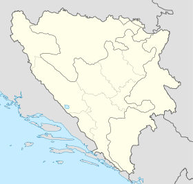
Bosnia and Herzegovina location map.svg
City locator 15.svg
Lišci

Lišci (en cyrillique : Лишци) est un village de Bosnie-Herzégovine. Il est situé dans la municipalité d'Olovo et dans le canton de Zenica-Doboj, Fédération de Bosnie-et-Herzégovine. Au recensement de 1991, il comptait 291 habitants, tous Musulmans (bosniaques)[1].

Sommaire

Notes et références

  1. (bs)(hr)(sr) Livre : Composition nationale de la population - Résultats de la République par municipalités et localités 1991, Bulletin statistique n°234, Publication de l'Institut national de statistique de Bosnie-Herzégovine, Sarajevo.

Voir aussi

Articles connexes

Liens externes


Wikimedia Foundation. 2010.

Contenu soumis à la licence CC-BY-SA. Source : Article Lišci de Wikipédia en français (auteurs)

Игры ⚽ Поможем решить контрольную работу

Regardez d'autres dictionnaires:

  • Liščí Mlýn — (Frenštát pod Radhoštěm,Чехия) Категория отеля: 3 звездочный отель Адрес: Bystré 664, Frenštát …   Каталог отелей

  • Holiday home Bedrichov (Lisci Farma) — (Bedřichov,Чехия) Категория отеля: Адрес: Bedřichov, 468 12, Ч …   Каталог отелей

  • Affittacamere Ca' Dei Lisci — (Риомаджоре,Италия) Категория отеля: Адрес: Via Colombo 36, 19017 Риомаджоре, Итали …   Каталог отелей

  • List of German exonyms for places in the Czech Republic — Below are links to subpages with more detailed listings of the German language names of towns and villages in different regions of the Czech Republic. Many of these German names are now exonyms, but used to be endonyms commonly used by the local… …   Wikipedia

  • Liste deutscher Bezeichnungen tschechischer Orte — In dieser Liste werden deutschen (heute großteils nicht mehr geläufigen) topografischen Namen die tschechischen, amtlichen Pendants gegenübergestellt. Durch die Vertreibungen nach 1945 wurden viele kleinere Orte und Gehöfte, insbesondere in… …   Deutsch Wikipedia

  • Olovo —  Pour l’article homonyme, voir Olovo (Kupres).  44° 07′ 48″ N 18° 34′ 58″ E …   Wikipédia en Français

  • herbata — I {{/stl 13}}{{stl 8}}rz. ż Ia, CMc. herbataacie {{/stl 8}}{{stl 20}} {{/stl 20}}{{stl 12}}1. {{/stl 12}}{{stl 7}} porcja napoju z liści rośliny o tej samej nazwie : {{/stl 7}}{{stl 10}}Zamówić trzy herbaty. {{/stl 10}}{{stl 20}} {{/stl 20}}{{stl …   Langenscheidt Polski wyjaśnień

  • Frankstadt unter dem Radhoscht — Frenštát pod Radhoštěm …   Deutsch Wikipedia

  • Frenštát pod Radhoštěm — Frenštát pod Radhoštěm …   Deutsch Wikipedia

  • Malé Labe — Kleine ElbeVorlage:Infobox Fluss/GKZ fehlt Lage Okres Trutnov, Královéhradecký kraj, Tschechien Flusssystem Elbe Abfluss über …   Deutsch Wikipedia

Share the article and excerpts

Direct link
Do a right-click on the link above
and select “Copy Link”