Man (Nicobar)
- Man (Nicobar)
-

Pour les articles homonymes, voir
Man.
Man, également appelée Laouk, est une île de l'archipel des Nicobar dans le Golfe du Bengale rattachée au groupe des îles du Centre.
Géographie
Cette section est vide, insuffisamment détaillée ou incomplète.
Votre aide est la bienvenue !
Man mesure 1,5 km de longueur et environ 0,75 km de largeur maximales pour une superficie de 1,7 km2. Elle est distante de 4 kilomètres de Tillangchong et de 21 kilomètres au nord de l'île de Camorta.
Histoire
Cette section est vide, insuffisamment détaillée ou incomplète.
Votre aide est la bienvenue !
Wikimedia Foundation.
2010.
Contenu soumis à la licence CC-BY-SA. Source : Article Man (Nicobar) de Wikipédia en français (auteurs)
Regardez d'autres dictionnaires:
Nicobar Islands — Map of Nicobar Islands The Nicobar Islands (Hindi: निकोबार द्वीप समूह or नारिकेलद्वीप, [nɪkoːˈbaːr ˈd̪ʋiːp səˈmuːɦ], Bengali: নিকোবর দ্বীপপুঞ্জ, Tamil: நக்காவரம்) are an archipelagic island chain in the eastern Indian Ocean. They are located in… … Wikipedia
Man — Cette page d’homonymie répertorie les différents sujets et articles partageant un même nom. Pour les articles homophones, voir Mane, Manne, Mann, Mahn et Mânes … Wikipédia en Français
List of lieutenant governors of the Andaman and Nicobar Islands — This is a list of Lieutenant Governors of the Andaman and Nicobar Islands, as well as precursor offices of similar scope, from the start of British resettlement of the Andaman Islands in 1858, at which time it was subordinated to British India.… … Wikipedia
Andaman and Nicobar Islands — Infobox Indian Jurisdiction type = union territory state name = Andaman and Nicobar Islands native name = Andaman and Nicobar Islands base base map label = no capital = Port Blair largest city = Port Blair latd = 11.68 longd = 92.77 abbreviation … Wikipedia
List of Lieutenant Governors of the Andaman and Nicobar Islands — This is a list of Lieutenant Governors of the Andaman and Nicobar Islands, as well as precursor offices of similar scope, from the start of British resettlement of the Andaman Islands in 1858, at which time it was subordinated to British India.In … Wikipedia
Îles Nicobar — Géographie Pays Inde Coordonnées … Wikipédia en Français
Andaman and Nicobar Islands — Andamanen und Nikobaren Status: Unionsterritorium Hauptstadt: Port Blair (121.000 Einwohner) Fläche: 8.249 km² Einwohner: 415.000 (2008) … Deutsch Wikipedia
Andaman and Nicobar Islands — An′da•man and Nic′o•bar Is′lands [[t]ˈæn də mən; ˈnɪk əˌbɑr, ˌnɪk əˈbɑr[/t]] n. pl. geg a union territory of India, comprising the Andaman and Nicobar island groups in the E part of the Bay of Bengal, SW of Burma. 280,661; 3143 sq. mi. (8140 sq.… … From formal English to slang
India — /in dee euh/, n. 1. Hindi, Bharat. a republic in S Asia: a union comprising 25 states and 7 union territories; formerly a British colony; gained independence Aug. 15, 1947; became a republic within the Commonwealth of Nations Jan. 26, 1950.… … Universalium
Liste der Inseln Indiens — Eine der unbewohnten Inseln Lakshadweeps Die Liste der Inseln Indiens führt alphabetisch bzw. nach Archipelen geordnet die zu Indien gehörenden Inseln auf. Inselgruppe der Andamanen: Barren Island 8,10 km² … Deutsch Wikipedia
 Inde
Inde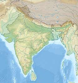
 Man
Man