Camorta
- Camorta
-
Camorta est la deuxième plus importante île de l'archipel des Nicobar dans le Golfe du Bengale.
Géographie
Cette section est vide, insuffisamment détaillée ou incomplète.
Votre aide est la bienvenue !
Camorta, située dans le groupe des îles du centre, mesure 25,7 km de longueur et environ 7 km de largeur maximales pour une superficie de 188,2 km2. Elle est séparée de quelques centaines de mètres de l'île de Nancowry.
Histoire
Cette section est vide, insuffisamment détaillée ou incomplète.
Votre aide est la bienvenue !
Wikimedia Foundation.
2010.
Contenu soumis à la licence CC-BY-SA. Source : Article Camorta de Wikipédia en français (auteurs)
Regardez d'autres dictionnaires:
Camorta — bezeichnet: ein britisches Passagierschiff, siehe Camorta (Schiff) eine indische Insel, siehe Camorta (Insel) Diese Seite ist eine Begriffsklärung zur Unterscheidung mehrerer mit demselben Wort bezeichneter Begriffe … Deutsch Wikipedia
Camorta — Camorta, Insel im Bengalischen Meerbusen, zur Gruppe Nikobar gehörig, zwischen den Andamaninseln u. der Sundainsel Sumatra (SAsien); waldig, an der SOKüste guter Hafen. 1778 versuchten[602] hier die Österreicher eine Colonie zu gründen, standen… … Pierer's Universal-Lexikon
Camorta — Unreferenced|date=May 2008Camorta is one of the Nicobar Islands, India. Its area is 188 km² … Wikipedia
Camorta (Schiff) — Camorta p1 … Deutsch Wikipedia
Camorta (Insel) — Camorta Karte der Nikobaren Gewässer Indischer Ozean Inselgruppe … Deutsch Wikipedia
SS Camorta — was a steamship owned by the British India Steam Navigation Company which sunk in the Irrawaddy Delta on 6 May 1902 with the loss of all 655 passengers and 82 crew. She was en route from Madras, India, to Rangoon, Burma, across the Bay of Bengal … Wikipedia
Каморта — (Camorta, Car Morta) или Никавари один из Никобарских о в в Бенгальском зал., под 8° 2 с. ш. и 93° 40 в. д., 40 км в длину и от 5 до 12 км в ширину; узким проливом отделяется от острова Нанкаури и вместе с тем образует прекрасно защищенную и… … Энциклопедический словарь Ф.А. Брокгауза и И.А. Ефрона
Καμόρτα — (Camorta). Νησί (151 τ. χλμ.) της Ινδίας στον κόλπο της Βεγγάλης. Ανήκει στο νησιωτικό σύμπλεγμα Ανταμάν και Νικομπάρ της Ινδίας … Dictionary of Greek
Central Nicobarese languages — Central Nicobarese Nancowry, Camorta, Katchal Spoken in India Region Camorta, Nancowry, Katchal, Trinket Islands, Nicobars Native speakers … Wikipedia
Atrophaneura aristolochiae — Common Rose Common Rose in Hyderabad, India Scientific classification Kingdom … Wikipedia
 Inde
Inde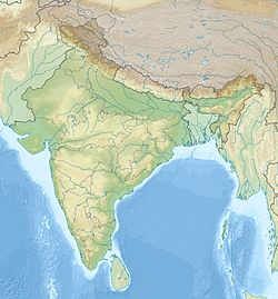
 Camorta