Lamberhurst Quarter
- Lamberhurst Quarter
-
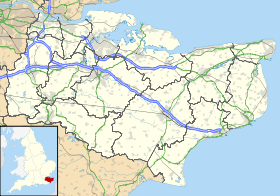
Lamberhurst Quarter est un petit hameau sur la route A21, dans le comté du Kent. Il est près du village de Lamberhurst.
Sur les autres projets Wikimedia :
Wikimedia Foundation.
2010.
Contenu soumis à la licence CC-BY-SA. Source : Article Lamberhurst Quarter de Wikipédia en français (auteurs)
Regardez d'autres dictionnaires:
Matfield — For other uses, see Matfield (disambiguation). Coordinates: 51°08′56″N 0°21′53″E / 51.1488°N 0.3648°E / 51.1488; 0.3648 … Wikipedia
A21 road — UK road routebox caption= A21 at Scotney Castle. road= A21 length mi= 63 length km= 101 direction= Northwest Southeast start= London (Lewisham) destinations= Bromley Orpington Swanley Sevenoaks Royal Tunbridge Wells end= Hastings construction… … Wikipedia
Royal Tunbridge Wells — Tunbridge Wells redirects here. For other uses, see Tunbridge Wells (disambiguation). Coordinates: 51°08′00″N 0°15′53″E / 51.1332°N 0.2647°E … Wikipedia
Oast house — A traditional oast An oast, oast house or hop kiln is a building designed for kilning (drying) hops as part of the brewing process. They can be found in most hop growing (and former hop growing) areas and are often good examples of vernacular… … Wikipedia
Edward Hasted — (31 December1732 ndash;1812) was the author of The History and Topographical Survey of the County of Kent (1788 ndash;99)LifeHasted was born in London, the son of Edward Hasted by his wife Ann of Sutton at Hone near Dartford, Kent. His… … Wikipedia
Wikipedia:List of Wikipedians by number of edits — Shortcuts: WP:NOE WP:WBE WP:EDITS WP:MOSTEDITS This is a list of Wikipedians ordered by number of edits in the English language Wikipedia. Edits in all namespaces are counted; deleted edits have been included in recent versions. Click… … Wikipedia
 Angleterre
