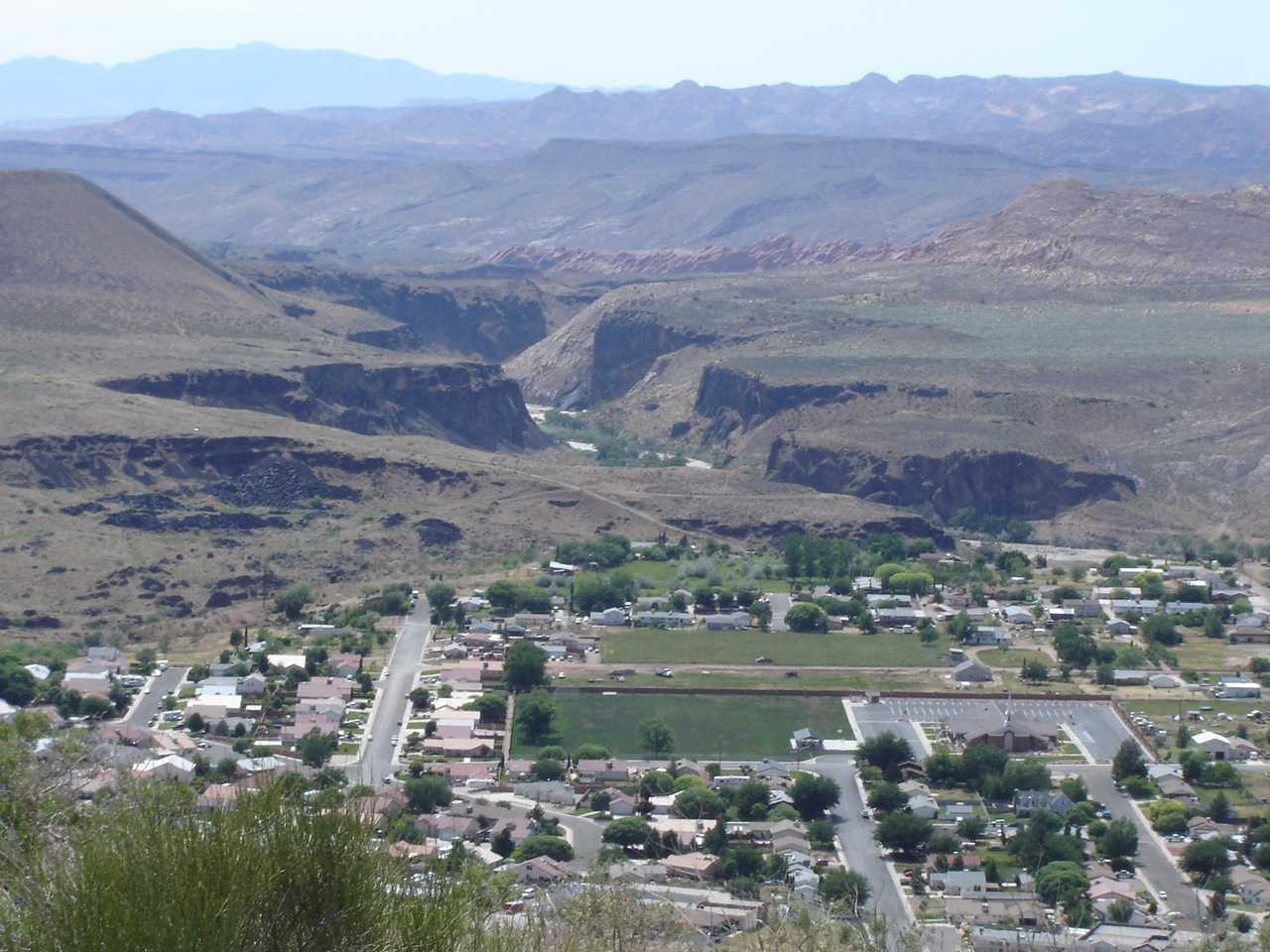
La Verkin
Contenu soumis à la licence CC-BY-SA. Source : Article La Verkin de Wikipédia en français (auteurs)
Regardez d'autres dictionnaires:
La Verkin, Utah — Infobox Settlement official name = La Verkin, Utah settlement type = City nickname = motto = imagesize = image caption = image mapsize = 250px map caption = Location of La Verkin, Utah mapsize1 = map caption1 = subdivision type = Country… … Wikipedia
La Verkin (Utah) — La Verkin es una ciudad el condado de Washington, estado de Utah, Estados Unidos. Según el censo de 2000, la población era de 3.392 habitantes. Geografía La Verkin se encuentra en las coordenadas … Wikipedia Español
La Verkin — La Verkin, UT U.S. city in Utah Population (2000): 3392 Housing Units (2000): 1158 Land area (2000): 16.127955 sq. miles (41.771210 sq. km) Water area (2000): 0.000000 sq. miles (0.000000 sq. km) Total area (2000): 16.127955 sq. miles (41.771210… … StarDict's U.S. Gazetteer Places
La Verkin, UT — U.S. city in Utah Population (2000): 3392 Housing Units (2000): 1158 Land area (2000): 16.127955 sq. miles (41.771210 sq. km) Water area (2000): 0.000000 sq. miles (0.000000 sq. km) Total area (2000): 16.127955 sq. miles (41.771210 sq. km) FIPS… … StarDict's U.S. Gazetteer Places
Utah State Route 9 — Infobox road state=UT type=SR route=9 alternate name=Zion Park Scenic Byway section=106 maint=UDOT length mi=57.075 length round=3 length ref=Utah Department of Transportation, [http://www.udot.utah.gov/main/f?p=100:pg:2814615533739116:::1:T,V:814… … Wikipedia
Utah State Route 17 — Infobox road state=UT type=SR route=17 section=107 maint=UDOT length mi=6.060 length round=3 length ref= [http://www.dot.utah.gov/main/uconowner.gf?n=15551223354766387 UDOT Highway Reference, SR 17] ] established=1969 direction a=South terminus a … Wikipedia
Ash Creek (Utah) — Der Ash Creek bei Pintura, mit Blick auf die Hurricane CliffsVorlage:Infobox Fluss/KARTE fehlt … Deutsch Wikipedia
Utah State Route 59 — Infobox road state=UT type=SR route=59 section=113 maint=UDOT length mi=22.206 length round=3 length ref=cite web | title=State Route 59 Highway reference | publisher=Utah Department of Transportation |… … Wikipedia
Svavar Guðnason — fæddist á [Höfn í Hornafirði] [http://is.wikipedia.org/wiki/Hornafj%C3%B6r%C3%B0ur] þann 18. nóvember 1909. Snemma kom í ljós hvert hugur Svavars stefndi. Svavar komst í kynni við málaralistina á uppvaxtarárum sínum, mest fyrir tilstilli Bjarna… … Wikipedia
Utah State Route 9 — (SR 9) Autres noms Zion Park Scenic Byway Longueur 91,8 kilomètres … Wikipédia en Français

 États-Unis
 Utah
Utah