Kerep

Kerep

44° 48′ 36″ N 18° 32′ 55″ E / 44.8100, 18.5486

Kerep
Administration
Pays Drapeau de Bosnie-Herzégovine Bosnie-Herzégovine
Entité Drapeau de la Fédération de Bosnie-et-Herzégovine Fédération de Bosnie-et-Herzégovine
Canton Tuzla
Municipalité Gradačac
Géographie
Coordonnées 44° 48′ 36″ Nord
       18° 32′ 55″ Est
/ 44.8100, 18.5486
Démographie
Population 891 hab. (1991)
Localisation
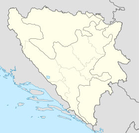
Bosnia and Herzegovina location map.svg
City locator 15.svg
Kerep

Kerep (en cyrillique : Кереп) est un village de Bosnie-Herzégovine. Il est situé dans la municipalité de Gradačac et dans le canton de Tuzla, Fédération de Bosnie-et-Herzégovine. Au recensement de 1991, il comptait 891 habitants, dont une majorité de Musulmans (Bosniaques)[1].

Sommaire

Démographie

Répartition de la population (1991)

Nationalité Nombre %
Musulmans 815 91,47
Serbes 57 6,39
Yougoslaves 17 1,90
Inconnus/autres 2 0,22[1]

En 1991, la communauté locale de Kerep comptait 2 206 habitants, répartis de la manière suivante[2] :

Nationalité Nombre %
Musulmans 2 128 96,46
Serbes 57 2,58
Yougoslaves 18 0,82
Inconnus/autres 3 0,14

Notes et références

  1. a et b (bs)(hr)(sr) Livre : Composition nationale de la population - Résultats de la République par municipalités et localités 1991, Bulletin statistique n°234, Publication de l'Institut national de statistique de Bosnie-Herzégovine, Sarajevo.
  2. (bs)(hr)(sr)[PDF] Recensement par communautés locales sur http://www.fzs.ba, Bosnie-Herzégovine - Fédération de Bosnie-et-Herzégovine - Institut fédéral de statistique. Consulté le 11 octobre 2010

Voir aussi

Articles connexes

Liens externes


Wikimedia Foundation. 2010.

Contenu soumis à la licence CC-BY-SA. Source : Article Kerep de Wikipédia en français (auteurs)

Игры ⚽ Нужен реферат?

Regardez d'autres dictionnaires:

  • Kerep Wetan — Original name in latin Kerep Wetan Name in other language Kerep Wetan State code ID Continent/City Asia/Jakarta longitude 6.7561 latitude 111.3904 altitude 60 Population 0 Date 2012 01 22 …   Cities with a population over 1000 database

  • Salto Angel — Salto del Ángel Kerepakupai merú Salto Angel vue de la base. Localisation Pays …   Wikipédia en Français

  • Gendhing — The gendhing (also written, as in the old orthography, gending) is a class of gendhing structures used in Javanese gamelan music. Gendhing can also used to refer to gamelan compositions in general.Gendhing is the longest and most complicated of… …   Wikipedia

  • Merong — The merong is a section of a composition for Javanese gamelan, a musical ensemble featuring metallophones, xylophones, drums, and gongs. Specifically, the merong is the initial part of a gendhing. A merong cannot be played on its own, but must be …   Wikipedia

  • Chutes Angel — Salto Angel 5° 58′ 03″ N 62° 32′ 08″ W / 5.9675, 62.535556 …   Wikipédia en Français

  • Gradačac — 44° 52′ 51″ N 18° 25′ 37″ E / 44.8808, 18.4269 …   Wikipédia en Français

  • Angel Falls — For the waterfall in Maine, see Angel Falls (Maine). Coordinates: 5°58′03″N 62°32′08″W / 5.9675°N 62.53556°W / 5.9675; 62.5 …   Wikipedia

  • Salto Ángel — (Kerepakupai Vená) Vista del salto Localización …   Wikipedia Español

  • Minggah — The minggah or inggah is a section of a gendhing composition for gamelan. It follows the merong, after an ompak. It is distinguished from the previous section by the use of kempyang. In the minggah section, the kempyang and kethuk play in the… …   Wikipedia

  • Bedhaya — The bedhaya (also written as bedoyo, beḍaya, and various other transliterations) is a sacred ritualized dance of Java, Indonesia, associated with the royal palaces of Yogyakarta and Surakarta. Along with the serimpi, the bedhaya epitomized the… …   Wikipedia

Share the article and excerpts

Direct link
Do a right-click on the link above
and select “Copy Link”