Jabal ad Dukhan
- Jabal ad Dukhan
-
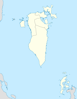
Le Jabal ad Dukhan (en arabe : جبل الدخان, « montagne de fumée ») est une colline du Bahreïn et le point culminant du pays. Il se situe à une altitude de 134 mètres.
Le Jabal ad Dukhan est nommé ainsi à cause de la brume qui l'entoure souvent par temps humide. Un certain nombre de grottes se trouve au voisinage de la montagne
Wikimedia Foundation.
2010.
Contenu soumis à la licence CC-BY-SA. Source : Article Jabal ad Dukhan de Wikipédia en français (auteurs)
Regardez d'autres dictionnaires:
Jabal al-Dukhan — (Arabic: smoke mountain ) is a mountain located in Saudi territory south west of the town in the province of Akhawbp tillage in Jizan, which borders the Mount Smoke path of the border between Saudi Arabia and Yemen from the south east and the… … Wikipedia
Jabal ad-Dukhan — Coordenadas: 25°59′38.69″N 50°34′59.7″E / 25.9940806, 50.58325 Jabal ad Dukhan, en árabe:جبل الدخان), es una montaña … Wikipedia Español
Operation Scorched Earth — For the military strategy, see Scorched earth. Operation Scorched Earth Part of the Sa dah insurgency Approximate Are … Wikipedia
Geography of Bahrain — Map of Bahrain Topography … Wikipedia
Bahrain Island — Infobox Islands name = Bahrain image caption = Bahrain island (center) seen from space image size = locator Location map|Bahrain|lat=26.035808|long=50.550842|marksize=16 map custom = yes native name = جزيرة البحرين native name link = Arabic… … Wikipedia
Geografía de Baréin — Mapa de Baréin. Mapa de relieve. Baréin (de la palabra … Wikipedia Español
Bahrain — /bah rayn , ruyn , beuh /, n. 1. a sheikdom in the Persian Gulf, consisting of a group of islands: formerly a British protectorate; declared independent 1971. 603,318; 232 sq. mi. (601 sq. km). Cap.: Manama. 2. the largest island in this group:… … Universalium
Geographie du Bahrein — Géographie du Bahreïn Géographie du Bahreïn Continent Asie Région Moyen Orient, Golfe Persique Coordonnées 26°00 N, 50°33 E … Wikipédia en Français
Géographie Du Bahreïn — Continent Asie Région Moyen Orient, Golfe Persique Coordonnées 26°00 N, 50°33 E … Wikipédia en Français
Géographie du Bahreïn — 26°00′N 50°33′E / 26, 50.55 … Wikipédia en Français

 Bahreïn

