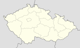
Hosín
Contenu soumis à la licence CC-BY-SA. Source : Article Hosín de Wikipédia en français (auteurs)
Regardez d'autres dictionnaires:
List of canonical coordinate transformations — This is a list of canonical coordinate transformations. 2 DimensionalLet (x, y) be the standard Cartesian coordinates, and r and θ the standard polar coordinates.To Cartesian coordinates from polar coordinates:x=r,cos heta quad:y=r,sin heta… … Wikipedia
CZ-311 — Der Okres České Budějovice (Bezirk Budweis) ist ein Bezirk in Tschechien. Er befindet sich in der Südböhmischen Region und enthält 107 Gemeinden. Der Bezirk erstreckt sich über eine Gesamtfläche von 1.625 km². Inhaltsverzeichnis 1 Fläche 2… … Deutsch Wikipedia
Okres České Budějovice — Kraj Jihočeský kraj Fläche 1 638,30 km² Einwohner • Bevölkerungsdichte 180 986 (2007) 110 Einw./km² Gemeinden • davon Städte • davon … Deutsch Wikipedia
Child abuse — Family law Entering into marriag … Wikipedia
Liste der Naturschutzgebiete im Jihočeský kraj — Lage des Jihočeský kraj in Tschechien Die Liste der Naturschutzgebiete im Jihočeský kraj umfasst kleinflächige geschützte Gebiete in der Region Südböhmen, Tschechien. Aufgenommen sind alle offiziell ausgewiesenen Naturreservate und Naturdenkmäler … Deutsch Wikipedia
České Budějovice — Coordinates: 48°58′29″N 14°28′29″E / 48.97472°N 14.47472°E / 48.97472; 14.47472 … Wikipedia
List of challenges in Takeshi's Castle — A wide range of challenges were used throughout the history of the Japanese game show Takeshi s Castle, some occurring only once or twice, or others in virtually every show, depending upon their popularity and ease of preparation. Many challenges … Wikipedia
Týn nad Vltavou — Coordinates: 49°13′24.23″N 14°25′14.04″E / 49.2233972°N 14.4205667°E / 49.2233972; 14.4205667 … Wikipedia
Nové Hrady (České Budějovice District) — Coordinates: 48°47′22.67″N 14°46′42.19″E / 48.7896306°N 14.7783861°E / 48.7896306; 14.7783861 … Wikipedia
Hilvan — is a district of Şanlıurfa Province of Turkey, 55km from the city of Şanlıurfa. Area 1.278 km². Population (2000 census) 38.411. The early history of the area is unclear but it was settled in the early 19th century by a nomadic tribe and was… … Wikipedia
 République tchèque
