Hanöbukten
- Hanöbukten
-
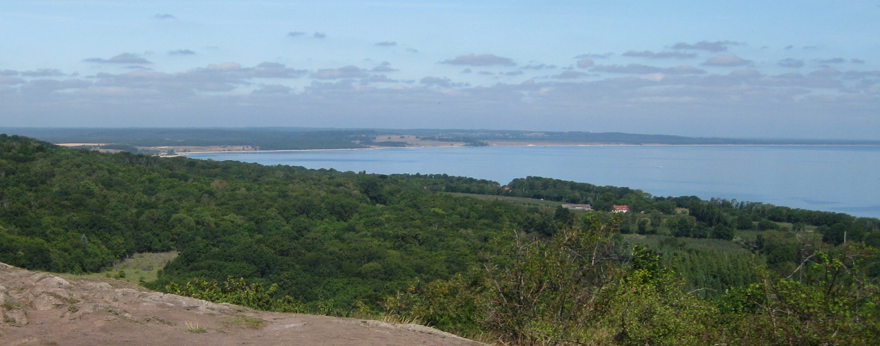
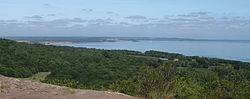
Hanöbukten est une baie de la mer Baltique située sur la côte de la Scanie et du Blekinge, en Suède. Elle tire son nom de l'île d'Hanö, située au nord de la baie. Elle s'étend de la colline de Stenshuvud au sud jusqu'à la péninsule de Listerlandet au nord.
Wikimedia Foundation.
2010.
Contenu soumis à la licence CC-BY-SA. Source : Article Hanöbukten de Wikipédia en français (auteurs)
Regardez d'autres dictionnaires:
Hanöbukten — Hanöbukten, the Bight of Hanö is a sandy bay, stretching from Listerlandet in the north to Stenshuvud in the south, on the east coast of Skåne, South Sweden … Wikipedia
Hanöbukten — Hanöbucht von Yngsjö aus, Blick auf Åhus. Hanöbucht bei Kivik. Die Hanöbucht (schwedisch Hanöbukten … Deutsch Wikipedia
Hanöbucht — 55.8514.333333333333 Koordinaten: 55° 51′ 0″ N, 14° 20′ 0″ O … Deutsch Wikipedia
Helgeå — is a river in Småland and Skåne, Sweden, which runs through Kristianstad and out to the Hanöbukten in the Baltic Sea.ee also*Battle of the Helgeå … Wikipedia
Åhus — is the second largest town of Kristianstad Municipality, Skåne County in southernmost Sweden. The population is 8,984 in the winter (2005) but it triplesFact|date=April 2007 in the summer due to the predominantly German tourists who come seeking… … Wikipedia
Kristianstads Vattenrike Biosphere Reserve — Kristianstads Vattenrike Biosphere Reserve, a protected swamp area in the Hammarsjön Lake, surrounding the town of Kristianstad in Scania, southern Sweden.The reserve was established in 2005. Here is Sweden s lowest point, 2,7 m under sea level.… … Wikipedia
Vesan — Lake Vesan = The lake system Vesan in Sölvesborg was from the beginning not a lake, but a strait up until the early 1920s. In the area between Ryssberget and Listerlandet, water from Hanöbukten flowed in and in effect cut of Listerlandet from the … Wikipedia
Kristianstad Vattenrike — La reserva de la biosfera Kristianstads Vattenrike, una zona pantanosa protegida en el lago Hammarsjön, rodeando la ciudad de Kristianstad en Escania, al sur de Suecia. El punto más bajo de Suecia se encuentra en la reserva a 2,41 metros bajo el… … Wikipedia Español
Projet:Maritime — Bienvenue sur la page du Projet du monde maritime ! Elle recense les participants aux projets, les ressources utiles, les règles et conventions habituelles, et permet la communication entre les participants … Wikipédia en Français
Parc national de Stenshuvud — La colline emblématique de Stenshuvud Catégorie UICN III (monument naturel) Identifiant … Wikipédia en Français
 Suède
Suède