Ham (Kent)
- Ham (Kent)
-
Ham est un hameau près de la ville de Sandwich dans le Kent et fait partie du civil parish de Northbourne.
Il y a un panneau à proximité qui souligne à la fois le hameau et la ville, on peu lire «Ham Sandwich»=«sandwich au jambon».
Sur les autres projets Wikimedia :
Wikimedia Foundation.
2010.
Contenu soumis à la licence CC-BY-SA. Source : Article Ham (Kent) de Wikipédia en français (auteurs)
Regardez d'autres dictionnaires:
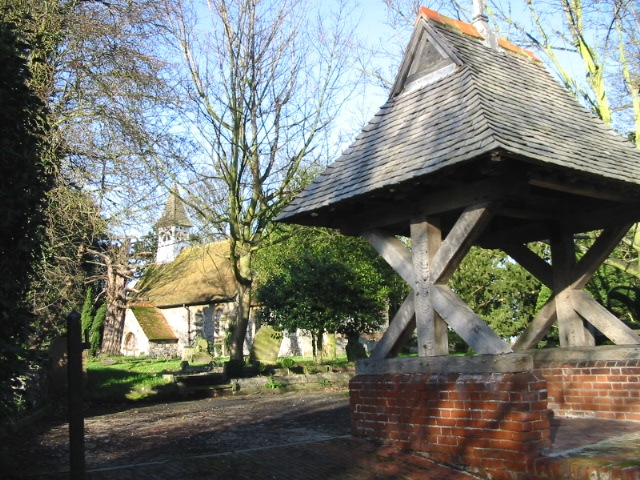
Ham, Kent — infobox UK place country = England static static image caption=Ham church and lych gate official name= Ham latitude= 51.245 longitude= 01.33 population = shire district= Dover shire county = Kent region= South East England Ambulance= constituency … Wikipedia
Ham Hill — could refer to:* Ham Hill, Somerset SSSI, Country Park and Iron Age hill fort * Ham Hill SSSI, WiltshireThere is also a lesser known area to the south of Snodland, Kent that is called Ham Hill. It has always played second fiddle to the larger… … Wikipedia
Ham Street Woods — Infobox SSSI name=Ham Street Woods aos=Kent interest=Biological gridref=TQ996352 area=172.2 hectares (425.5 acres) notifydate=1951 http://www.natureonthemap.org.uk/map.aspx? ] Ham Street Woods is a Site of Special Scientific Interest (SSSI) near… … Wikipedia
Ham — Cette page d’homonymie répertorie les différents sujets et articles partageant un même nom. Pour les articles homophones, voir Hamm (homonymie), Hamme et Ame. Sommaire … Wikipédia en Français
Ham Street railway station — Infobox UK station name = Ham Street code = HMT manager = Southern locale = Hamstreet borough = Ashford lowusage0405 = 58,394 lowusage0506 = 66,533 lowusage0607 = 69,731 platforms = 2 start = 13 February 1851Ham Street railway station serves… … Wikipedia
Kent Hovind — Born Kent E. Hovind … Wikipedia
Ham, London — infobox UK place country = England map type = Greater London region= London population= official name= Ham latitude= 51.435457 longitude= 0.31047 constituency westminster= post town= RICHMOND postcode area= TW postcode district=TW10 london… … Wikipedia
Kent Wildlife Trust — Infobox Organization name = Kent Wildlife Trust image border = size = caption = msize = mcaption = motto = formation = 1958 extinction = type = headquarters = location = membership = 28,000 language = English leader title = leader name = key… … Wikipedia
Sandwich, Kent — Coordinates: 51°16′29″N 1°20′20″E / 51.27472°N 1.33889°E / 51.27472; 1.33889 For other uses, see Sandwich (di … Wikipedia
Gravesend, Kent — Long Reach redirects here. For the neighbourhood in the eastern United States, see Long Reach, Columbia, Maryland. Coordinates: 51°26′29″N 0°22′07″E / 51.4415°N 0.3685°E … Wikipedia
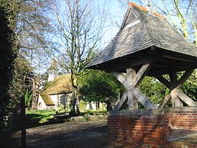 Eglise de Ham et lych gate
 Angleterre
 Ham
Ham