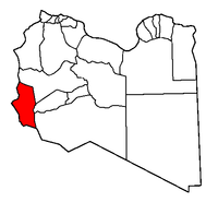
Ghat (district)
Contenu soumis à la licence CC-BY-SA. Source : Article Ghat (district) de Wikipédia en français (auteurs)
Regardez d'autres dictionnaires:
Ghat Roads — are the name of the access routes into the mountainous Western and Eastern Ghats mountain ranges of the Indian Subcontinent. These roads are remarkable feats of engineering and most date back to British times. Ghat roads were built to connect to… … Wikipedia
District Centres of Delhi — Below is a list of the various district centres of Delhi: Map showing the nine districts of Delhi. Contents 1 South Delhi … Wikipedia
Wayanad district — Wayanad district … Wikipedia
Nilgiri Ghat Roads — Many Ghat Roads can be found in the Nilgiris District of Tamil Nadu, Southern India. Nearly all of the district is located in the Nilgiri Hills, part of the Western Ghats mountains. This area borders the states of Karnataka and Kerala. The hills… … Wikipedia
Barabanki district — Infobox Indian Jurisdiction native name = Barabanki type = District Headquarter locator position = left latd = 26.5 longd = 81.7 state name = Uttar Pradesh district = Barabanki leader title = Chairman leader name = Hafeez Bharti blank title 1 =… … Wikipedia
Malshej Ghat — Malshej Hills Malshej Ghat (Marathi: माळशेज घाट ) is a mountain pass in the Western Ghats range in pune district of Maharashtra, India. The site is nestled in the lofty rugged hills of the Western Ghats. The best time to visit is between August… … Wikipedia
Jashpur district — lies in the north eastern corner of the state of Chhattisgarh in India adjoining the border of Bihar, Jharkhand, and Orissa.GeographyThe North South length of this district is about 150 km, and its East West breadth is about 85 km. Its total area … Wikipedia
Kodagu district — Kodagu ಕೊಡಗು district … Wikipedia
Hassan district — Infobox Indian Jurisdiction native name = Hassan district ಹಾಸನ type= district district district image desc = Taluk level map of Hassan district latd = 13 district lat m = longd = 76 district long m = state name = Karnataka division name = taluk… … Wikipedia
Massacre Ghat — Satti Chaura Ghat, Kanpur, Ganges river … Wikipedia