Flower Mound
Contenu soumis à la licence CC-BY-SA. Source : Article Flower Mound de Wikipédia en français (auteurs)
Regardez d'autres dictionnaires:
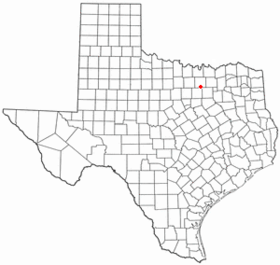
Flower Mound — Lage von Flower Mound in Texas Basisdaten … Deutsch Wikipedia
Flower Mound — Flower Mound, TX U.S. town in Texas Population (2000): 50702 Housing Units (2000): 16833 Land area (2000): 40.874984 sq. miles (105.865717 sq. km) Water area (2000): 2.499301 sq. miles (6.473160 sq. km) Total area (2000): 43.374285 sq. miles (112 … StarDict's U.S. Gazetteer Places
Flower Mound, TX — U.S. town in Texas Population (2000): 50702 Housing Units (2000): 16833 Land area (2000): 40.874984 sq. miles (105.865717 sq. km) Water area (2000): 2.499301 sq. miles (6.473160 sq. km) Total area (2000): 43.374285 sq. miles (112.338877 sq. km)… … StarDict's U.S. Gazetteer Places
Flower Mound — Original name in latin Flower Mound Name in other language Flower Mound State code US Continent/City America/Chicago longitude 33.01457 latitude 97.09696 altitude 186 Population 64669 Date 2011 05 14 … Cities with a population over 1000 database
Flower Mound, Texas — Infobox Settlement official name = Flower Mound, Texas settlement type = Town mapsize = 250px map caption = Location of Flower Mound in Denton County, Texas nickname = The Mound, Flo Mo subdivision type = Country subdivision type1 = State… … Wikipedia
Flower Mound High School — Infobox School name = Flower Mound High School motto = A World Class School Educating Tomorrow s Leaders type = Public High School phone = 469 713 5192 fax = 972 691 5826 established = 1999 principal = Paul Moon faculty =141 street = 3411 Peters… … Wikipedia
Flower Mound — geographical name town N Texas N of Arlington population 50,702 … New Collegiate Dictionary
Lamar Middle School (Flower Mound, Texas) — Infobox School name =Lamar Middle School motto =Excellence Without Exception established =1987 type =Public affiliation = district =Lewisville Independent School District grades =6 8 president = principal =Mr. Mike Fields head of school = dean =… … Wikipedia
Mound (Begriffsklärung) — Mound steht für Mound künstliche Hügel in den Vereinigten Staaten; hiervon abgeleitet als Pitcher s Mound eine Spielfläche in der Sportart Baseball Bhir Mound, Ruine in Pakistan Burnt Mound Fundplätze aus der Bronzezeit auf den Britischen Inseln … Deutsch Wikipedia
Church of the Little Flower (Coral Gables, Florida) — The Church of the Little Flower is a Catholic Church located in the Roman Catholic Archdiocese of Miami at 1270 Anastasia Avenue, Coral Gables, Florida. Established in 1926, it is one of the oldest in the metropolitan Miami area and is considered … Wikipedia
 États-Unis
 Texas
Texas