- Flatanger
-
Flatanger 
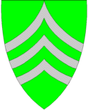
Blason de Flatanger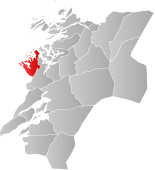
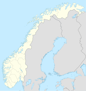
Localisation de Flatanger dans le Nord-TrøndelagAdministration Pays  Norvège
Région Trøndelag Comté Nord-Trøndelag Centre administratrif Lauvsnes Géographie Coordonnées Superficie 460,23 km² Démographie Population 1 138 hab. (2008) Densité 2,47 hab./km² Gentilé Flatangring Langue officielle Neutre Géolocalisation sur la carte : Norvège

modifier 
Flatanger est une municipalité du comté de Nord-Trøndelag en Norvège. Elle fait partie de la région du Namdalen.
Catégorie :- Kommune de Nord-Trøndelag


Wikimedia Foundation. 2010.