Eriboll
Contenu soumis à la licence CC-BY-SA. Source : Article Eriboll de Wikipédia en français (auteurs)
Regardez d'autres dictionnaires:
Eriboll — (Scottish Gaelic: Euraboll ) is a village in Scotland on the eastern shore of Loch Eriboll. It lies in the northern part of the former county of Sutherland.Its Norse name (meaning Home on a gravel beach ) reveals the dominant culture of 1000… … Wikipedia
Eriboll — Eriboll, tiefe Bucht an der Nordküste der schottischen Grafschaft Sutherland, mit vorzüglichem Ankergrund … Pierer's Universal-Lexikon
Loch Eriboll — Le loch Eriboll Administration Pays … Wikipédia en Français
Loch Eriboll — Loch Eriboll … Deutsch Wikipedia
Loch Eriboll — Países Reino Unido Región … Wikipedia Español
Loch Eriboll — (Scottish Gaelic: Loch Euraboil ) is a 16km long sea loch on the North Coast of Scotland, which has been used for centuries as a deep water anchorage as it is safe from the often stormy seas of Cape Wrath and the Pentland Firth. It is named for… … Wikipedia
Loch Eriboll — Sp Èribolo įlanka Ap Loch Eriboll angliškai Sp Lòch Èribolas Ap Loch Éuraboll geliškai (škotiškai) L Atlante, Jungtinė Karalystė, D. Britanija (Škotija) … Pasaulio vietovardžiai. Internetinė duomenų bazė
Durness — DURNESS, a parish, in the county of Sutherland, 20 miles (N. W. by W.) from Tongue, and 76 (N. W.) from Golspie, containing 1109 inhabitants. This parish, of which the name is of doubtful origin, anciently comprised the whole of the lands… … A Topographical dictionary of Scotland
Liste deutscher U-Boote (1935–1945)/U 751–U 1000 — Deutsche U Boote (1935–1945): U 1–U 250 | U 251–U 500 | U 501–U 750 | U 751–U 1000 | U 1001–U 1250 | U 1251–U 1500 | U 1501–U 4870 Diese Liste behandelt ausschließlich die deutschen U Boote U 751 bis U 1000 des Zweiten Weltkrieges der Jahre 1935… … Deutsch Wikipedia
Liste deutscher U-Boote (1935–1945)/U 1001–U 1250 — Deutsche U Boote (1935–1945): U 1–U 250 | U 251–U 500 | U 501–U 750 | U 751–U 1000 | U 1001–U 1250 | U 1251–U 1500 | U 1501–U 4870 Diese Liste behandelt ausschließlich die deutschen U Boote U 1001 bis U 1250 des Zweiten Weltkrieges der Jahre 1935 … Deutsch Wikipedia
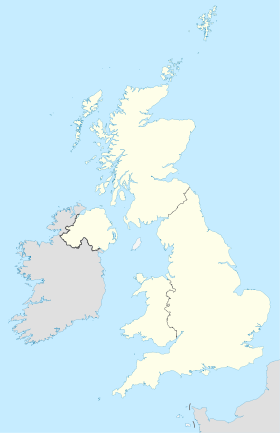
 Royaume-Uni
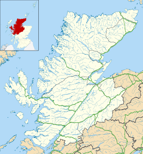
 Eriboll