East Hill (Kent)
- East Hill (Kent)
-
East Hill est un hameau de West Kingsdown , dans le district de Sevenoaks, dans le comté du Kent.
Localisation
East Hill est d'environ huit miles au sud ouest de la ville de Sevenoaks et environ quatre miles au nord du village de Kemsing et à environ deux miles au sud ouest de le de village West Kingsdown.
hameaux à proximité
Hameaux proches comprennent Romney Street, Woodlands, Knatts Valley, Maplescombe, Knockmill est Cotmans Ash.
Équipements
Il s'agit d'un cours de golf dix-huit trous et une douzaine de bois voisins. Il a aussi un camping.
Transports
Le hameau se trouve sur une route sans issue (East Hill Road). Mais à quelques miles il y a la route A20 et A225 et aussi les autoroutes M20 , M26 et M25. La gare la plus proche est la gare de Otford , à environ quatre miles.
Sur les autres projets Wikimedia :
Wikimedia Foundation.
2010.
Contenu soumis à la licence CC-BY-SA. Source : Article East Hill (Kent) de Wikipédia en français (auteurs)
Regardez d'autres dictionnaires:
Windmill Hill, Kent — infobox UK place country = England latitude= 51.434989 longitude= 0.371518 official name = Windmill Hill population = shire district= Gravesham shire county = Kent region= South East England constituency westminster= Gravesham post town=… … Wikipedia
Temple Hill, Kent — infobox UK place country = England official name=Temple Hill static static image caption= latitude= 51.449720 longitude= 0.225170 population = civil parish= shire district=Dartford shire county= Kent region= South East England constituency… … Wikipedia
Kent (Washington) — Kent Lage der Stadt im County und des Countys im Bundesstaat … Deutsch Wikipedia
Kent — County of Kent redirects here. For other uses, see Kent County (disambiguation). For other uses, see Kent (disambiguation). Kent Invicta Motto of County … Wikipedia
Kent, Washington — Infobox Settlement official name = Kent, Washington settlement type = City nickname = imagesize = image caption = image mapsize = 250px map caption = Location of Kent, Washington mapsize1 = map caption1 = subdivision type = Country subdivision… … Wikipedia
Kent School District — The Kent School District #415 includes the cities of Kent, Covington, Maple Valley, parts of the cities of Renton and Black Diamond, and neighboring unincorporated areas in King County, Washington. Covering 73 square miles (189,069,132 m²), the… … Wikipedia
East Providence (Rhode Island) — 41° 48′ 05″ N 71° 21′ 39″ W / 41.8014, 71.3608 East Providence e … Wikipédia en Français
East London Line — Class 378 train at Whitechapel Overview Type Suburban rail System … Wikipedia
East London Line — Saltar a navegación, búsqueda East London line Color en el mapa Naranja Año de apertura 1869 Año de clausura 2007 Tipo de línea Subsuperficial Material roda … Wikipedia Español
Kent — /kent/, n. 1. James, 1763 1847, U.S. jurist. 2. Rockwell /rok wel , weuhl/, 1882 1971, U.S. illustrator and painter. 3. William, 1685 1748, English painter, architect, and landscape gardener. 4. a county in SE England. 1,445,400; 1442 sq. mi.… … Universalium
 Angleterre
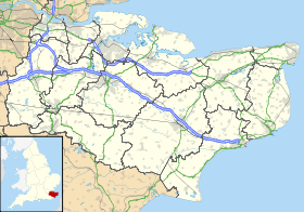
 East Hill