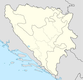
Donja Kočela
Contenu soumis à la licence CC-BY-SA. Source : Article Donja Kočela de Wikipédia en français (auteurs)
Regardez d'autres dictionnaires:
Donja Kočela — Village Country Bosnia and Herzegovina Municipality … Wikipedia
Gornja Kočela — 42° 44′ 07″ N 18° 15′ 26″ E / 42.7353, 18.2572 … Wikipédia en Français
List of settlements in Bosnia and Herzegovina — This is a complete list of settlements in Bosnia and Herzegovina, as recorded by 1991 census, sorted by municipalities. Town of Sarajevo = Sarajevo Centar = • Mrkovići • Nahorevo• Poljine• Radava• Sarajevo (part of settlement)• Vića Sarajevo… … Wikipedia
Trebinje — Pour les articles homonymes, voir Trebinje (homonymie). 42° 42′ 43″ N 18° 20′ 39″ E … Wikipédia en Français
Trebinje — Infobox Settlement settlement type = subdivision type = Country subdivision name =Bosnia and Herzegovinasubdivision type1 = Entity subdivision name1 = Republika Srpska subdivision type2 = subdivision name2 = timezone=CET utc offset=+1 timezone… … Wikipedia
Trebišnjica River — is a river in Bosnia and Herzegovina, Montenegro and Croatia. It is a sinking river, 98 km long above the ground. With a total length of 187 km above and under the ground, it is one of the longest sinking rivers in the world. Upper course As it… … Wikipedia
Trebisnjica — Die Trebišnjica im Zentrum von Trebinje Die Trebišnjica (kyrillisch Требишњица) ist ein Fluss in Bosnien und Herzegowina, Montenegro und Kroatien, der 98 km oberirdisch und weitere 89 km unterirdisch verläuft. Die Trebišnjica fließt durch die… … Deutsch Wikipedia
Trebišnjica — Die Trebišnjica im Zentrum von Trebinje Die Trebišnjica (kyrillisch Требишњица) ist ein Fluss in Bosnien und Herzegowina, Montenegro und Kroatien, der 98 km oberirdisch und weitere 89 km unterirdisch verläuft. Die Trebišnjica fließt… … Deutsch Wikipedia
Ljubomir (Trebinje) — Pour les articles homonymes, voir Ljubomir. 42° 49′ 08″ N 18° 18′ 00″ E … Wikipédia en Français
Vrpolje Ljubomir — Pour les articles homonymes, voir Ljubomir. 42° 46′ 22″ N 18° 21′ 10″ E … Wikipédia en Français
 Bosnie-Herzégovine
 République serbe de Bosnie
