Cronk y Voddy
- Cronk y Voddy
-
54° 14′ 19″ N 4° 36′ 22″ W / 54.238635, -4.606233
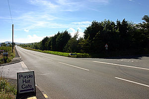
Vue du nord-est, à Cronk y Voddy, en direction du Glen Helen.
Cronk y Voddy (parfois écrit Cronk y Vody) est un bourg de l'île de Man, situé dans la paroisse de German, à mi-distance entre Kirk Michael, au nord, et Saint John's, au sud. On y trouve une ancienne chapelle anglicane, aujourd'hui déconsacrée et aménagée en demeure privée[1]. Elle a été construite en 1852[2].
Toponymie
Le nom Cronk y Voddy est composé des noms cronk (« colline ») et modey (« chien »). Il désigne la « colline du chien » ou la « colline des chiens[3] ».
Notes et références
- ↑ (en) An illustrated encyclopedia of the Isle of Man, The Manx Experience, Douglas, 1997, p. 44.
- ↑ (en) « German Parish and Churches, Isle of Man », isleofman.com.
- ↑ (en) A. W. Moore, M. A, The Surnames and Place-Names of the Isle of Man, Elliot Stock, Londres, 1890, p. 194.
Wikimedia Foundation.
2010.
Contenu soumis à la licence CC-BY-SA. Source : Article Cronk y Voddy de Wikipédia en français (auteurs)
Regardez d'autres dictionnaires:
Cronk-ny-Mona — (Manx: Hill of the turbary)[1]is situated between the 36th Milestone and 37th Milestone road side marker on the Snaefell Mountain Course on the primary A18 Mountain Road and the road junction with the A21 Johnny Watterson Lane and the tertiary… … Wikipedia
Cronk Urleigh — (Manx: Keeil Pharlane formerly Reneurling the hill or ridge of slaughter)[1] is a corner situated at the 13th Milestone road side marker on the Snaefell Mountain Course used for the Isle of Man TT Races on the primary A3 road in the parish of… … Wikipedia
11th Milestone — Infobox TT course Name = 11th Milestone Caption = TT marker board for the 11th Milestone Latitude = 54.245 Longitude = 4.596 OSgridref = SC309863 Parish = German Distance = 11.3 Follows = Handley s Corner Precedes = Cronk y Voddy11th Milestone or … Wikipedia
Snaefell Mountain Course — Mountain Course … Deutsch Wikipedia
Sarah's Cottage, Isle of Man — Sarah s Cottage (Manx: Vaish or Ballavaish) is a corner situated between the 9th Milestone and 10th Milestone road side markers on the Snaefell Mountain Course used for the Isle of Man TT Races on Creg Willey s Hill and Ballavaish on the primary… … Wikipedia
Snaefell Mountain Course — Mountain Course Localización Douglas, Isla de Man Eventos TT Isla de Man; Manx Grand Prix Longi … Wikipedia Español
Creg-ny-Baa — Keppel Hotel or Creg ny Baa Public House … Wikipedia
Snaefell Mountain Course — Motorsport venue Name = Mountain Course | Location = Douglas, Isle of Man Time = GMT Events = Isle of Man TT, Manx Grand Prix Length km = 60.72 Length mi = 37.733 Turns = 200+ Record time = 17:21.99 Record driver = John McGuinness Record team =… … Wikipedia
Crosby Cross-Roads — Isle of Man TT … Wikipedia
Creg Willey's Hill — (Manx: Willy Syl s (Sylvester) crag)[1] is situated adjacent the 10th Milestone road side marker on the Snaefell Mountain Course used for the Isle of Man TT Races on the junction of the primary A3 Castletown to Ramsey road in the parish of German … Wikipedia

