Colonial Creek Falls
- Colonial Creek Falls
-
Colonial Creek Falls est une chute d'eau des États-Unis.
Caractéristiques
Au total, la chute d'eau mesure 788 m de haut.
La cascade mesure 15 m de large.
Localisation
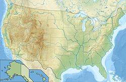
Colonial Creek Falls est située sur le Colonial Peak, un sommet du parc national des North Cascades dans l'État de Washington, aux États-Unis.
Voir aussi
Liens internes
Liens externes
Wikimedia Foundation.
2010.
Contenu soumis à la licence CC-BY-SA. Source : Article Colonial Creek Falls de Wikipédia en français (auteurs)
Regardez d'autres dictionnaires:
Depot Creek Falls — Location Whatcom County, Washington, USA Type Cascade Total … Wikipedia
Colonial Heights, Virginia — City Seal … Wikipedia
Colonial National Historical Park — IUCN Category V (Protected Landscape/Seascape) … Wikipedia
Yosemite Falls — Vue de la partie supérieure des chutes. Localisation Pays … Wikipédia en Français
Colonial Village, New York — is an unincorporated hamlet in the town of Lewiston in Niagara County, New York, USA.[1] References ^ U.S. Geological Survey Geographic Names Information System: Colonial Village, New York Coordinates … Wikipedia
Mazama Falls — Location Whatcom County, Washington, USA Coordinates 48°51′00″N 121°44′29″W … Wikipedia
Nooksack Falls — Location Mount Baker National Forest, Whatcom County, Washington, USA Coordinates … Wikipedia
Jacobs Creek (Pennsylvania) — Geobox River name = Jacobs Creek native name = other name = other name1 = |thumb image caption = Creek Falls (Chaintown, PA) country = United States state = Pennsylvania region type = Counties region = Westmoreland, PA region1 = Fayette, PA city … Wikipedia
Depot Valley Falls — Location Whatcom County, Washington, USA Type Cascade Total height 400 feet Number of drops 1 Depot Valley Falls is a 400 foot waterfall o … Wikipedia
Rondout Creek — Geobox|River name = Rondout Creek native name = other name = category = etymology = nickname = image caption = Rondout Creek at the eastern edge of the Catskills, between Napanoch and Rondout Reservoir. country = United States state = New York… … Wikipedia
 États-Unis


