Chartham Hatch
- Chartham Hatch
-
Chartham Hatch est un petit hameau d'environ 200 maisons dans le Kent. Situé à environ 5 miles au sud-ouest de Canterbury.
Sur les autres projets Wikimedia :
Wikimedia Foundation.
2010.
Contenu soumis à la licence CC-BY-SA. Source : Article Chartham Hatch de Wikipédia en français (auteurs)
Regardez d'autres dictionnaires:
Chartham Hatch — Coordinates: 51°15′18″N 1°01′14″E / 51.255°N 1.0205°E / 51.255; 1.0205 … Wikipedia
Chartham — Coordinates: 51°15′18″N 1°01′14″E / 51.255°N 1.0205°E / 51.255; 1.0205 … Wikipedia
Howfield Manor Canterbury (Canterbury (UK)) — Howfield Manor Canterbury country: United Kingdom, city: Canterbury (UK) (Chartham Hatch) Howfield Manor Canterbury Howfield Manor is located in the heart of the Kent countryside and set in five acres of landscaped gardens. The hotel offers 15… … International hotels
Canterbury — For the larger local government district, see City of Canterbury. For other uses, see Canterbury (disambiguation). Coordinates: 51°16′30″N 1°05′13″E / 51.275°N 1.0 … Wikipedia
City of Canterbury — For the settlement within the City of Canterbury, see Canterbury. For the local government area in Australia, see City of Canterbury (New South Wales). City of Canterbury Non metropolitan district, Borough, City … Wikipedia
Marshside, Kent — Coordinates: 51°21′03″N 1°11′35″E / 51.3508°N 1.1931°E / 51.3508; 1.1931 … Wikipedia
Chislet — Coordinates: 51°20′11″N 1°11′28″E / 51.336330°N 1.191000°E / 51.336330; 1.191000 … Wikipedia
Chestfield — Coordinates: 51°21′18″N 1°03′50″E / 51.355°N 1.064°E / 51.355; 1.064 … Wikipedia
Hoath — Coordinates: 51°20′00″N 1°09′27″E / 51.3334°N 1.1576°E / 51.3334; 1.1576 … Wikipedia
Nackington — Coordinates: 51°15′00″N 1°04′59″E / 51.25°N 1.083°E / 51.25; 1.083 … Wikipedia
 Angleterre
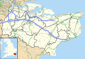
 Chartham Hatch