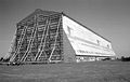
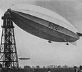
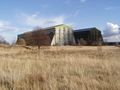
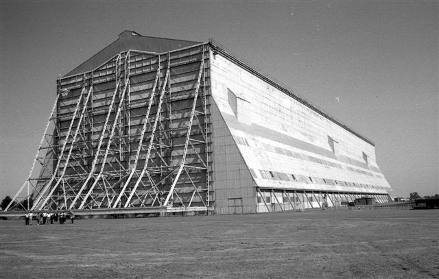
Cardington (Bedfordshire)
Contenu soumis à la licence CC-BY-SA. Source : Article Cardington (Bedfordshire) de Wikipédia en français (auteurs)
Regardez d'autres dictionnaires:
Cardington, Bedfordshire — infobox UK place country = England latitude= 52.1161 longitude= 0.4139 official name= Cardington population = 316 (2001 census) shire district= Bedford shire county = Bedfordshire region= East of England constituency westminster= North East… … Wikipedia
Cardington — ist der Name folgender Orte: Cardington (Bedfordshire) Cardington (Shropshire) Cardington (Südafrika) Cardington (Ohio) Cardington Township (Ohio) Diese Seite ist eine Begriffsklärung zur Unterscheidung mehrerer mit demselben Wort bezei … Deutsch Wikipedia
Cardington — may refer to:*Cardington, Bedfordshire *Cardington, Shropshire *Cardington, Ohio … Wikipedia
Cardington — Cette page d’homonymie répertorie les différents sujets et articles partageant un même nom. Cardington peut faire référence à: Cardington (Bedfordshire), village d Angleterre au sud est de Bedford Cardington (Shropshire) (en), village d… … Wikipédia en Français
Cardington test — The Cardington Fire Tests were a series of large scale fire tests conducted in real steel framed structures at the village of Cardington, Bedfordshire, England.Funded by DETR Partners in Technology, the BRE Centre for Fire Safety Engineering… … Wikipedia
Bedfordshire — Flag of Bedfordshire Motto of County Council: Constant Be … Wikipedia
Civil parishes in Bedfordshire — A map of Bedfordshire, showing the districts: (1) Bedford; (2) Central Bedfordshire; and (3) Luton A civil parish is a subnational entity, forming the lowest unit of local government in England. There are 125 civil parishes in the ceremonial… … Wikipedia
Riseley, Bedfordshire — Coordinates: 52°15′05″N 0°28′37″W / 52.2514°N 0.4769°W / 52.2514; 0.4769 … Wikipedia
Toddington, Bedfordshire — Coordinates: 51°57′N 0°32′W / 51.95°N 0.53°W / 51.95; 0.53 … Wikipedia
Shillington, Bedfordshire — Coordinates: 51°59′06″N 0°21′36″W / 51.98488°N 0.3601°W / 51.98488; 0.3601 … Wikipedia
 Pour les articles homonymes, voir Cardington.