Cahaba
- Cahaba
-
Cahaba (orthographié également Cahawba) fut la capitale de l'État d'Alabama aux États-Unis de 1820 à 1825[1]. C'est aujourd'hui une ville fantôme et un site classé historique. Le site est situé dans le comté de Dallas (Alabama), au sud-ouest de Selma (Alabama)[2].
Cette section est vide,
insuffisamment détaillée ou incomplète.
Votre aide est la bienvenue !
Gallerie
-
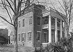
Perine, probablement à la fin du 19ème siècle.
-
L'église épiscopale de St. Luke en 1934.
-
L'église méthodiste dans les années 1930, plus tard détruite par le feu.
-
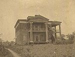
Le manoir Kirkpatrick incendié en 1935.
-
L'école privée pour jeunes filles en 1903.
-
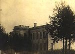
Le manoir Perine avec ses trente-six chambres mansion, construit dans les années 1850s et plus tard démoli.
-
Une autre vue du manoir Perine.
-
Le manoir Crocheron construit en 1843, incendié au début du vingtième siècle.
-
Notes et références
Article connexe
v · sièges de comtés de l’ État de l’ Alabama  |
|
|
Catégories : - Municipalité de l'Alabama
- Ancienne capitale d'État américain
Wikimedia Foundation.
2010.
Contenu soumis à la licence CC-BY-SA. Source : Article Cahaba de Wikipédia en français (auteurs)
Regardez d'autres dictionnaires:
Cahaba — ist der Name mehrerer Orte in den Vereinigten Staaten: Cahaba (Alabama) Cahaba (North Carolina) Cahaba Crest (Alabama) Cahaba Heights (Alabama) Cahaba Hills (Alabama) Cahaba River Estates (Alabama) Fließgewässer Cahaba River, Alabama … Deutsch Wikipedia
Cahaba — can refer to:* The Cahaba River in Alabama * Cahaba, Alabama (or Cahawba), an extinct town in Alabama * Cahaba Prison (or Cahawba Prison), a Confederate prison* Cahawba County > Bibb County, Alabama … Wikipedia
Cahaba — Ca·ha·ba (kə hôʹbə, häʹ ) A river rising in the Appalachian Mountains of north central Alabama near Birmingham and flowing about 322 km (200 mi) generally south to the Alabama River near Selma. * * * ▪ historical village, Alabama, United States… … Universalium
Cahaba pebblesnail — Black and white photo of apertural view of the shell of Clappia cahabensis Scientific classification Kingdom … Wikipedia
Cahaba Shiner — Conservation status Critically Endangered (IUCN 2.3) Scientific classification … Wikipedia
Cahaba (rivière) — Cahaba Cahaba River Caractéristiques Longueur 307 km Bassin 4 843 km2 Bassin collecteur … Wikipédia en Français
Cahaba Heights — Cahaba Heights, AL U.S. Census Designated Place in Alabama Population (2000): 5203 Housing Units (2000): 2730 Land area (2000): 2.034586 sq. miles (5.269553 sq. km) Water area (2000): 0.000000 sq. miles (0.000000 sq. km) Total area (2000):… … StarDict's U.S. Gazetteer Places
Cahaba Heights, AL — U.S. Census Designated Place in Alabama Population (2000): 5203 Housing Units (2000): 2730 Land area (2000): 2.034586 sq. miles (5.269553 sq. km) Water area (2000): 0.000000 sq. miles (0.000000 sq. km) Total area (2000): 2.034586 sq. miles… … StarDict's U.S. Gazetteer Places
Cahaba River — Geobox | River name = Cahaba River category = River image size = 300 image caption = The Cahaba River in the Cahaba River National Wildlife Refuge etymology = country = United States country state = Alabama region type = County region = district … Wikipedia
Cahaba, Alabama — Infobox nrhp name = Cahaba Cahawba nrhp type = caption = St. Lukes Episcopal Church, moved from Cahaba in the 1876 to Martin s Station, moved back to Cahaba in 2007. lat degrees = lat minutes = lat seconds = lat direction = long degrees = long… … Wikipedia


