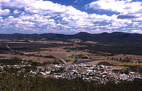
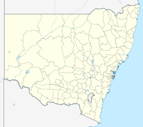
Bulahdelah
Contenu soumis à la licence CC-BY-SA. Source : Article Bulahdelah de Wikipédia en français (auteurs)
Regardez d'autres dictionnaires:
Bulahdelah — Original name in latin Bulahdelah Name in other language Bulahdelah, Bullah Delah State code AU Continent/City Australia/Sydney longitude 32.40698 latitude 152.21185 altitude 13 Population 1595 Date 2012 02 28 … Cities with a population over 1000 database
Bulahdelah Motor Lodge — (Bulahdelah,Австралия) Категория отеля: Адрес: 67 71 Bulahdelah Way, 2423 Bu … Каталог отелей
Bulahdelah, New South Wales — ] A 2 lane concrete bridge over Myall River was completed in 1969.Fact|date=August 2007In 1970 the Bulahdelah tornado swept through the nearby forests, just north of Bulahdelah in what was Australia s most destructive tornado on record.On 3 May… … Wikipedia
Bulahdelah tornado — Infobox tornado single name = Bulahdelah Tornado image location = date = 1 January 1970 time = fujitascale = F? total damages (USD) = Unknown total fatalities = None area affected = BulahdelahThe Bulahdelah Tornado was an intense tornado which… … Wikipedia
Bulahdelah — /bʊləˈdilə/ (say booluh deeluh) noun a town in eastern NSW, on the Myall River …
Pacific Highway (Australia) — Infobox Australian Road road name = Pacific Highway route route route photo = caption = see other route designations below Under conversion to [cite web|url=http://www.ozroads.com.au/NSW/Special/MAB/evidence.htm|title=Alpha Numeric Route… … Wikipedia
AusLink — is an Australian Government land transport funding program, established in June 2004 and administered by the Department of Transport and Regional Services. It was first proposed in a [http://www.auslink.gov.au/publications/policies/pdf/Green… … Wikipedia
Port Macquarie, New South Wales — Infobox Australian Place | type = town name = Port Macquarie state = nsw caption = Location of Port Macquarie in New South Wales (red) lga = Port Macquarie Hastings Council county = Macquarie postcode = 2444 pop = 39,219 (2006)Census 2006 AUS |… … Wikipedia
Highways in New South Wales — New South Wales Highways of New South Wales The present highway network in New South Wales, Australia … Wikipedia
Myall River — The Singing Bridge across the Myall River at Tea Gardens/Hawks Nest Origin Great Dividing Range at … Wikipedia
 Bulahdelah
 Australie

